How to Incorporate Mesh Blocks into Datasets

How to Incorporate Mesh Blocks into Datasets

Mesh Blocks in real estate and proptech applications

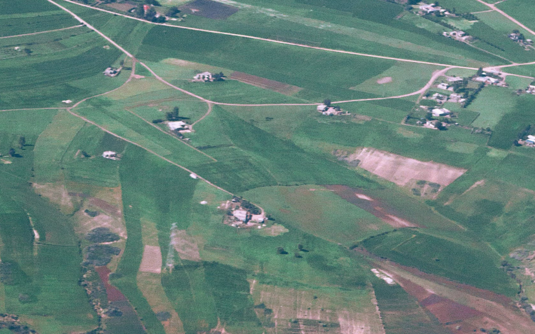
Mesh Blocks are useful for geospatial and proptech applications, providing granularity and accuracy for understanding local real estate markets, demographics and land use.

The integration of Mesh Blocks into datasets can enhance the precision and relevance of analyses within the proptech and real estate sectors.

Useful in geospatial data and census analyses, embedding Mesh Blocks into digital boundaries enhances their usability in various applications.

We will cover the steps to incorporate mesh blocks into data sets below.

What are Mesh Blocks and how are they used in real estate?

Mesh Blocks are foundational building blocks for geospatial and proptech applications, providing granularity and accuracy for understanding local real estate markets, demographics and land use.

How to incorporate Mesh Blocks into datasets

Incorporating Mesh Block into datasets involves several steps to ensure seamless integration and effective utilisation of geographical information. Here’s a guide on how to incorporate Mesh Blocks into datasets:

Step 1: Data Collection

Gather relevant data that aligns with Mesh Blocks.

This may include demographic information, property values, land use details, or any other dataset that can be associated with specific geographical areas.


Step 2: Download Mesh Block Boundaries

Mesh Block boundary files can be downloaded from authoritative sources, such as the Australian Bureau of Statistics (ABS) or relevant statistical agencies.

For ease, The Proptech Cloud has a free comprehensive dataset Geography – Boundaries & Insights – Australia ready for access and immediate use.

Geography – Boundaries & Insights – Australia

This free dataset from The Proptech Cloud is available for seamless access from Snowflake Marketplace.

Step 3: Geospatial Data Processing

Use Geographic Information System (GIS) software or programming libraries (e.g., Python with geospatial libraries like GeoPandas) to process and manipulate the mesh block boundaries.

Tip:

Geographical boundaries can be imported using Python libraries including Geopandas and shapely.

Many data warehouses including Snowflake, BigQuery and PostgreSQL have in-built geospatial functionality to allow for the processing of geospatial data.

QGIS – Loading in Geospatial files in QGIS

1. From the toolbar at the top of the page click Layer > Add Layer > Add Vector Layer

2. Make sure the Source Type is clicked to File

3. Load in the Source Data by using the three dots button at the side of the Vector Dataset(s) toolbar

QGIS - Loading in Geospatial files in QGIS

Geospatial Formats

The two most common ways geospatial data are represented in files are Well-Known-Text (WKT) which is a textual representation of a polygon and the geojson format which shows the coordinates and type of geojson format.

Both Python and Snowflake have capabilities to work with these 3 formats and parse them so they can be used in geography functions

WKT Format

#Example 2 using WKT format

from shapely import wkt

brisbane_bbox = “POLYGON ((153.012021 -27.471741, 153.012021 -27.462598, 153.032931 -27.462598, 153.032931 -27.471741, 153.012021 -27.471741))”

brisbane_poly = wkt.loads(brisbane_bbox)

Python – Loading in GeoJSON

The libraries geojson, shapely and json need to be installed.

#EXAMPLE 1 working with a geojson format

import json

import geojson

from shapely.geometry import shape

geojson_example = {

"coordinates": [[[153.01202116, -27.47174129], [153.01202116, -27.46259798], [153.03293092, -27.46259798], [153.03293092, -27.47174129], [153.01202116, -27.47174129]]],

"type": "Polygon"

}

geojson_json = json.dumps(geojson_example)

# Convert to geojson.geometry.Polygon

geojson_poly = geojson.loads(geojson_json)

poly = shape(geojson_poly ))

Snowflake

GeoJSON and WKT format can also be loaded into snowflake and converted to a geometry using the following commands:

#converting Well-Known-Text into geography format

SELECT ST_GEOGRAPHYFROMWKT('POLYGON ((153.012021 -27.471741, 153.012021 -27.462598, 153.032931 -27.462598, 153.032931 -27.471741, 153.012021 -27.471741))');

#Converting Geojson to geography format

SELECT TO_GEOGRAPHY('{

"coordinates": [[[153.01202116, -27.47174129], [153.01202116, -27.46259798], [153.03293092, -27.46259798], [153.03293092, -27.47174129], [153.01202116, -27.47174129]]],

"type": "Polygon"

}

')

Step 4: Data Matching

Match the dataset records with the appropriate mesh blocks based on their geographical coordinates. This involves linking each data point to the corresponding mesh block within which it is located.

Tip:

Geospatial functions which are supported in big data warehouses and Python can be used to match geospatial data.

A common way to match two geographical objects is to see if the coordinates of the two objects intersect. An example of how to do this in Python and Snowflake is shown below.

In Python

Data matching can be done using the shapely library intersects function.

from shapely import wkt, intersects

shape1 = wkt.loads("POLYGON ((153.012021 -27.471741, 153.012021 -27.462598, 153.032931 -27.462598, 153.032931 -27.471741, 153.012021 -27.471741))")

shape2 = wkt.loads("POLYGON ((153.012021 -27.471741, 153.032931 -27.462598, 153.012021 -27.471741))")

shape_int = intersects(shape1, shape2)

print(shape_int)


In Snowflake

Data matching can be done using the ST_Intersects function. One of the advantages of using big data warehouses including Snowflake to geospatially match data is that it leverages its highly scalable infrastructure to quickly complete geospatial processing.

WITH geog_1 as (

SELECT ST_GEOGRAPHYFROMWKT('POLYGON ((153.012021 -27.471741, 153.012021 -27.462598, 153.032931 -27.462598, 153.032931 -27.471741, 153.012021 -27.471741))') as poly

),

geog_2 as (

SELECT ST_GEOGRAPHYFROMWKT('POLYGON ((153.012021 -27.471741, 153.022021 -27.465, 153.032931 -27.462598, 153.012021 -27.471741))') as poly

)

SELECT

g1.poly, g2.poly

FROM geog_1 as g1

INNER JOIN geog_2 as g2

on ST_INTERSECTS(g1.poly, g2.poly)

Step 5: Attribute Joining

If your dataset and mesh blocks data have common attributes (e.g., unique identifiers), perform attribute joins to combine information from both datasets. This allows you to enrich your dataset with additional details associated with mesh blocks.

Step 6: Quality Assurance

Verify the accuracy of the spatial integration by checking for any discrepancies or errors. Ensure that each data point is correctly associated with the corresponding mesh block.

Tip:

geojson.io is a handy website that can help with visualising geojson data and ensure it is correct.

If you’re using Snowflake, the ST_AsGeojson command can be used to convert geography into a geojson which allows you to quickly visualise the shapes created.

Step 7: Data Analysis and Visualisation

Leverage the integrated dataset for analysis and visualisation. Explore trends, patterns, and relationships within the data at the mesh block level. Utilise geospatial tools to create maps and visual representations of the information.

Tip:

It’s worth mentioning that Snowflake has the option to create a Streamlit app within the Snowflake UI which allows for the cleaning and processing of data using Python and SQL and the interactive visualisation of data through the Streamlit App.

Read our blog which demonstrates how to predict migration patterns and create forecasts using Snowpark and Streamlit>

Snowflake also integrates really well with local Python development environments so all the initial data processing and cleaning can be done through a Snowflake API, then geography can be converted to a GeoJson or Text formal. Thereafter, libraries like plotly, folium, pydeck can be used to do complex geospatial visualisations.

Step 8: Data Storage and Management

Establish a system for storing and managing the integrated dataset, ensuring that it remains up-to-date as new data becomes available.

Consider using databases or platforms that support geospatial data.

Tip:

Geospatial datasets are usually very large and complex datasets due to the number of attributes included in a geospatial dataset, the resolution of the data and the number of records.

Cloud-based big data platforms can be an excellent option for storing geospatial data due to the low-cost of storage. Many of these platforms including also have spatial clustering options so that geospatial data in a similar location are grouped together, meaning queries for data in certain areas run more efficiently.

Snowflake (Enterprise Edition or Higher) also has an option to add a search optimisation to geospatial data tables to optimise the performance of queries that use geospatial functions.

Step 9: Documentation

Document the integration process, including the source of mesh block boundaries, any transformations applied, and the methods used for data matching. This documentation is essential for transparency and replicability.

By following these above steps, you can effectively incorporate mesh blocks into your datasets, enabling a more detailed and location-specific analysis of the information at the mesh block level.


Geography – Boundaries & Insights – Australia

This free dataset from The Proptech Cloud is available for seamless access from Snowflake Marketplace.

The intellectual property rights for all content in this blog are exclusively held by Data Army and The Proptech Cloud. All rights are reserved, and no content may be republished or reproduced without express written permission from us. All content provided is for informational purposes only. While we strive to ensure that the information provided here is both factual and accurate, we make no representations or warranties of any kind about the completeness, accuracy, reliability, suitability, or availability with respect to the blog or the information, products, services, or related graphics contained on the blog for any purpose.

Subscribe to our newsletter

Subscribe to receive the latest blogs and data listings direct to your inbox.

Read more blogs from The Proptech Cloud

Crafting a Storm Surge and Hurricane Risk Rating for Coastal Properties

A high-level approach to developing a storm surge and hurricane risk rating system to guide stakeholders with a vested interest in coastal properties.

How Proptech Is Revolutionising Real Estate

Proptech is the dynamic intersection of property and technology, and it’s reshaping real estate. And there’s still a huge potential for growth.

What is the Australian Statistical Geography Standard (ASGS)?

The ASGS is used to better understand where people live and how communities are formed.

How to Incorporate Mesh Blocks into Datasets

Mesh blocks can enhance the precision and relevance of geospatial and proptech analyses. Here are some tips and steps to incorporate mesh blocks into datasets.

Australia’s Migration Trends: Where Are People Moving To?

This detailed visual analysis for Australia’s major capital cities breaks down how net migration trends are evolving across different regions.

Understanding Auction Clearance Rates: Why Do Calculations Differ?

Understanding Auction Clearance Rates: Why Do Calculations Differ?

Auction clearance rates can serve as a barometer of Australia’s real estate market strength, particularly across its major cities.

These rates are generally a superficial gauge of market strength, because private treaty is still the most common means of property sale in some cities. Nevertheless, property predictions can be drawn when auction clearance rates are analysed alongside other factors and data points.

Clearance rates for Australia’s major real estate markets can be helpful for proptechs who leverage data, analytics, and technology to advance various aspects of the real estate industry.

What Is An Auction Clearance Rate?

The auction clearance rate typically represents the percentage of properties that sold on its advertised auction date in a specific market versus the number of properties that didn’t sell during a particular time frame (typically a week or month).

How Are Auction Clearance Rates Calculated?

There are variations in how clearance rates are calculated and reported, so it’s important to consider this and understand your data provider’s calculations. The variance in calculations means these metrics offer different views and are not interchangeable.


Variations to the Calculation

Calculation

Calculation (%)

Basic calculationPercentage of properties sold on auction date during a particular period (week or month)Basic calculation of auction clearance rates
Includes properties sold prior to and during auctionPercentage of properties sold prior to plus on auction date during a particular period (week or month)Basic Calculation + Properties sold prior to auction
Includes properties sold prior to, during and after auctionPercentage of properties sold prior to auction plus on auction date plus after auction date during a particular period (week or month)Sold prior + at + after auction Calculation 


What Do Auction Clearance Rates Tell Us?

Auction clearance rates are a crucial market indicator of real estate activity by gauging the numbers of buyers and sellers in a specific market during a certain time frame.

Generally, higher auction clearance rates indicate a higher buyer demand for property in that market, limited supply of available properties and/or with an increased likelihood of rising price, i.e. a hot market for sellers.

Conversely, low auction clearance rates indicates weak buyer demand, possible over-supply of properties and chance of reduced prices which is more favourable to buyers.

In Sydney and Melbourne, a clearance rate above 70% signals a seller’s market, below 60% suggests a buyer’s market, and 60-70% indicates balance.

But the true significance of auction clearance rates lies in its contextual analysis alongside factors such as listing numbers, days on market, withdrawn auctions, fluctuations and regional disparities.

By tracking these rates alongside additional metrics, analysts can anticipate market direction, and measure buyer and seller confidence.

Where Can I Find Clearance Rates For Australia’s Capital Cities?

Auction clearance rates in Australia are reported on a weekly basis.

Some organisations collect data from sales agents and aggregate the data by city and region, such as:

Some news outlets, auction houses and real estate agencies may also publish auction clearance rates for specific regions. Industry reports and analyses related to real estate may also compile this data to provide a comprehensive view into trends.

How Important Are Auction Clearance Rates?

For anyone involved in or impacted by the real estate market, auction clearance rates are an important indicator of demand levels, market sentiment, and potential shifts in property values. But when comparing available data, its crucial to understand the methodology behind the calculations of auction clearance rates.

Auction clearance rates should be used as part of a comprehensive analysis alongside other property data, localised research, and broader market factors. While auction clearance rates offer valuable insights into the direction of the property market, they are just one of many factors to consider, and a holistic approach incorporating various data points is recommended for a thorough understanding of market conditions.

How Might Auction Clearance Rates Be Used By Proptechs?

While not exhaustive, these are a few examples of how auction clearance rates might be used by proptechs and businesses working with real estate data.

  • By analysing clearance rates and buyer demand, price trends can be used to gauge competitiveness of the market. These could all be incorporated into tool development or software development, it could be used to optimise platform features, or to guide content creation to engage users.
  • Combining this information with localised data for property investment, integrating clearance rate data into risk assessment models could allow for more informed investment decisions.
  • Property valuation models could be enhanced with the use of real-time clearance rate data which provides more accurate and dynamic property valuations in areas of high auction activity.

Subscribe to our newsletter

Subscribe to receive the latest blogs and data listings direct to your inbox.

Read more blogs from The Proptech Cloud

Crafting a Storm Surge and Hurricane Risk Rating for Coastal Properties

A high-level approach to developing a storm surge and hurricane risk rating system to guide stakeholders with a vested interest in coastal properties.

How Proptech Is Revolutionising Real Estate

Proptech is the dynamic intersection of property and technology, and it’s reshaping real estate. And there’s still a huge potential for growth.

What is the Australian Statistical Geography Standard (ASGS)?

The ASGS is used to better understand where people live and how communities are formed.

How to Incorporate Mesh Blocks into Datasets

Mesh blocks can enhance the precision and relevance of geospatial and proptech analyses. Here are some tips and steps to incorporate mesh blocks into datasets.

Australia’s Migration Trends: Where Are People Moving To?

This detailed visual analysis for Australia’s major capital cities breaks down how net migration trends are evolving across different regions.

Understanding Housing Affordability: Key Metrics and Statistics

Understanding Housing Affordability: Key Metrics and Statistics

Housing affordability is a significant concern in many parts of the world, affecting the quality of life and economic wellbeing of individuals and families.

Professor Nicole Gurran from the School of Architecture, Design and Planning says governments around the world are searching for solutions to fix housing affordability, with two opposing schools of thought seeing the solutions as:

  1. Increasing supply. Those in support of this point of view see housing as more expensive because there’s not enough new supply. They see land use regulation and planning processes as restrictive to new construction, adding costly delays and uncertainty to the development process.
  2. On the flipside, others argue that ‘demand side’ factors underlying global house price inflation, such as low cost credit under financial deregulation, or government incentives to encourage property investment are being ignored. They highlight the political influence of property industry groups sustaining housing demand while advocating for reduced regulations. Some even suggest that extensive rezoning reforms may trigger surges in redevelopment and gentrification, potentially displacing individuals with lower incomes.

To truly understand the dynamics of housing affordability we need to take a detailed look at a range of different metrics and statistics to gain a full picture.

Shedding light on these crucial measures can offer insights for homebuyers, policymakers, real estate professionals, and urban planners.

1. Median and Average Home Prices

These figures provide a baseline for understanding the cost of purchasing a home in a particular area, with the median providing a middle point and the average presenting an overall trend.

2. Price-to-Income Ratio

This critical ratio compares home prices to average household incomes. A higher ratio suggests that homes are less affordable relative to income.

3. Housing Affordability Measures

A Housing Affordability Index (HAI) assesses whether a typical family can afford the mortgage on a median-priced home, based on their income. An index above 100 indicates greater affordability.

The issue with the HAI is that it primarily focuses on purchase affordability.

The Australian Institute of Health and Welfare (AIHW) broadens what they classify as housing costs in measuring housing affordability.

AIHW defines housing costs as

the sum of rent payments, rate payments (water and general), and housing–related mortgage payments”,

AIHW expresses housing affordability as

“the ratio of housing costs to gross household income”,

While housing stress is typically described as

lower-income households that spend more than 30% of gross income on housing costs“.

The second measure is a more comprehensive approach which considers a range of housing costs, the complexity of housing affordability and its impact on households.

4. Rent-to-Income Ratio

Rent-to-Income Ratio compares a tenant’s monthly rent to their gross monthly income expressed as a ratio. For those in the rental market, this ratio measures how much of a household’s income is spent on rent, with higher values indicating less affordability.

Rental property

5. Mortgage Interest Rates

Interest rates directly affect the cost of borrowing money for home purchases.

An increase in mortgage interest rates typically mean an increase in mortgage repayments, which can negatively impact affordability.

While a reduction in rates typically means reduced mortgage repayments, which may improve affordability.

6. Mortgage Payment as a Percentage of Income

Mortgage payment as a percentage of income is an important measure of affordability by demonstrating the burden of mortgage payments relative to a household’s income.

This percentage is calculated by dividing monthly mortgage repayments by gross monthly wages. 

The recommended figure is 28% of pre-tax income. Or in other words, no more than 28% of gross monthly income should go towards monthly mortgage repayments.

7. Homeownership Rates

Broad changes in homeownership rates can signal shifts in affordability, and the overall health of the housing market. 

To gain an idea of homeownership rates in Australia, AIHW shares a view of Home ownership and housing tenure in Australia.

8. Cost of Living

Several measures are published to calculate and help gauge changes in the cost of living. Changes in cost of living impacts our household purchasing power and has implications for housing demand. 

The main ways we measure cost of living is the Consumer Price Index.

Consumer Price Index (CPI)

According to the Australian Bureau of Statistics, CPI is a measure of the average change over time in the prices paid by households for a fixed basket of goods and services (which is grouped into 11 categories: Food and non-alcoholic beverages, Alcohol and tobacco, Clothing and footwear, Housing, Furnishings, household equipment and services, Health, Transport, Communication, Recreation and culture, Education, and Insurance and financial services).

 It’s important to note that the calculation of CPI does not include the cost of buying established dwellings, nor mortgage repayments. However, it does include rents, the cost of new dwellings (excluding value of land) and major alterations and additions to dwellings. 

Included in CPI

Not included in CPI

  • Rent
  • Cost of new dwellings (excluding value of land)
  • Major alterations and additions to dwellings
  • Rates and charges
  • Utilities
  • The cost of buying established dwellings
  • The cost of purchasing land
  • Mortgage repayments
  • Costs associated with servicing a mortgage
Consumer Price Index

9. Gini Coefficient of Home Prices

The Gini Coefficient statistical measure is typically used as a measure of income inequality, although it can be used to assess inequality in various other contexts, including home values in a real estate market.

A Gini index of 0 represents perfect equality, while an index of 100 implies perfect inequality.

This measure can indicate the inequality in home values within a market, with higher values suggesting greater disparity.

10. Building Permits and Housing Starts

Building permits and housing starts are indicators of building activity and housing supply.  They can signal future market changes which may impact affordability.

11. Vacancy Rates

A vacancy rate is a measure of the percentage of all rental properties that are currently vacant and available for rent.

Fluctuations in vacancy rates can impact rental prices, as elevated rates often correlate with decreased rents, and conversely, lower vacancy rates may lead to higher rental prices.

12. Debt-to-Income Ratio

An individual’s Debt-to-Income Ratio is calculated by taking their total debt and dividing it by their annual income.

This ratio reflects a person’s capacity to afford housing in light of their existing debts.

14. Population Growth and Urbanisation

Rapid population increases or urbanisation can heighten housing demand, affecting affordability.

A Multifaceted View of Housing Affordability

These range of metrics offer a multifaceted and broader view of housing affordability, reflecting the many factors that impact pricing, while implicitly highlighting the complexities of the housing market.

They’re essential for making informed decisions, shaping policies, and understanding market trends.

By keeping a close eye on these indicators, stakeholders can better navigate the challenges and opportunities within the housing sector.

Subscribe to our newsletter

Subscribe to receive the latest blogs and data listings direct to your inbox.

Read more blogs from The Proptech Cloud

Crafting a Storm Surge and Hurricane Risk Rating for Coastal Properties

A high-level approach to developing a storm surge and hurricane risk rating system to guide stakeholders with a vested interest in coastal properties.

How Proptech Is Revolutionising Real Estate

Proptech is the dynamic intersection of property and technology, and it’s reshaping real estate. And there’s still a huge potential for growth.

What is the Australian Statistical Geography Standard (ASGS)?

The ASGS is used to better understand where people live and how communities are formed.

How to Incorporate Mesh Blocks into Datasets

Mesh blocks can enhance the precision and relevance of geospatial and proptech analyses. Here are some tips and steps to incorporate mesh blocks into datasets.

Australia’s Migration Trends: Where Are People Moving To?

This detailed visual analysis for Australia’s major capital cities breaks down how net migration trends are evolving across different regions.

The Role of Data in Real Estate Decisions

The Role of Data in Real Estate Decisions

Businesses use a wide range of data to confidently analyse trends, forecast changes, and identify opportunities. In today’s competitive real estate industry, the data behind informed business decisions can be the difference between success and failure.

Why is data-driven decision-making so important in real estate?

With the advent of big data and accessibility of data, companies are now able to make more accurate and strategic decisions by analysing information, key trends and metrics. Data-driven decision-making has become critical in real estate because it allows businesses to identify opportunities, reduce risks and maximise returns on investments.

Using data in real-estate decisions

Some examples may include:

  • Real estate investment decisions

    Real estate and related data as diverse as historical sales data, demographics, market demand, property valuations can be used to identify profitable investment and development opportunities, determine a value of a property and assess potential returns on property investments.

  • Retail analytics

    Property data together with foot traffic data, demographics, sales data, can play a role in location selections and market expansion decisions. It will also influence merchandising decisions such as retail promotions and campaigns, product placement, store layout and inventory management.

  • Real estate sales decisions

    By analysing current and historical market trends, businesses can determine optimal pricing strategies for properties. Similarly demographic data can be used to identify the target audience for a particular property and inform advertising and marketing efforts.

  • Mortgage and financing decisions

    For risk assessments, lenders use property data to evaluate the value and condition of collateral for mortgage loans, determining loan eligibility and interest rates.
    On the flipside, credit scoring models may incorporate property data to evaluate borrower creditworthiness.

  • Government and urban planning

    Urban planners use property data to identify areas in need of infrastructure development, such as roads, schools, and utilities. Governments may use property data to enforce zoning regulations and property tax assessments.

  • Building and construction planning

    Property data aids in estimating construction costs, project timelines, and feasibility studies.

  • Insurance underwriting and claims

    Insurers consider property data when determining premiums and coverage for homeowners and property insurance policies. Property data may play a role in processing claims by verifying property details and assessing damage.

  • Environmental impact assessment

    Property, environmental, regulatory and geospatial data may all factor into decisions made concerning property projects.

Tips for interpreting and analysing property data

While data-driven decision-making is a valuable tool in real estate, it is important to understand how to properly analyse and interpret property data.

Here are some tips to keep in mind:

  • Data Accuracy

    Ensure the data you’re using is accurate and up-to-date. Rely on reputable sources and verify the information where possible.

  • Compare and Contrast

    Don’t make decisions based on a single data point. Compare property data from different sources and periods to identify trends and outliers.

  • Consider Context

    Understand the broader economic and market context in which the data exists. External factors like interest rates, local regulations, and economic conditions can significantly impact real estate data.

  • Data Visualisation

    Utilise data visualisation tools to transform complex data sets into easy-to-understand graphs and charts. Visual representations can highlight patterns and trends.

  • Consult Experts

    When in doubt, seek advice from experienced proptech professionals or data scientists and analysts. They can provide valuable insights and guidance in interpreting property data effectively.

  • Human Judgement

    Don’t ignore intuition and personal experience entirely. Data is important, but it should be used to inform decisions, not replace human judgement.

As we’ve explored, various types of data play a pivotal role in shaping business decisions. In an era of big data and accessible information, real estate professionals have the tools at their disposal to analyse trends, forecast changes, and seize opportunities like never before.

Businesses can navigate the intricate terrain of real estate with greater precision, with data illuminating the path.

Human judgment and expertise are still indispensable. Seek out experts, draw from your intuition, and let data guide your decisions, not dictate them.

    Read more blogs from The Proptech Cloud

    Crafting a Storm Surge and Hurricane Risk Rating for Coastal Properties

    A high-level approach to developing a storm surge and hurricane risk rating system to guide stakeholders with a vested interest in coastal properties.

    How Proptech Is Revolutionising Real Estate

    Proptech is the dynamic intersection of property and technology, and it’s reshaping real estate. And there’s still a huge potential for growth.

    What is the Australian Statistical Geography Standard (ASGS)?

    The ASGS is used to better understand where people live and how communities are formed.

    How to Incorporate Mesh Blocks into Datasets

    Mesh blocks can enhance the precision and relevance of geospatial and proptech analyses. Here are some tips and steps to incorporate mesh blocks into datasets.

    Australia’s Migration Trends: Where Are People Moving To?

    This detailed visual analysis for Australia’s major capital cities breaks down how net migration trends are evolving across different regions.

    What is a Cadastre?

    What is a Cadastre?

    Cadastres are used extensively in real estate and beyond. We break down what they are, how they’re stored, used and maintained in Australia.

    What is a cadastre?

    A cadastre is a comprehensive register or database that captures detailed information about real estate or land within a specific jurisdiction; with each cadastral record defining its respective boundary, as determined by cadastral surveying. Important attributes such as property location, characteristics, and value are also included in a cadastre.

    Essentially, it serves as a vital legal and administrative tool for managing and regulating land ownership and usage, while also used for collecting property taxes, assessing land values, and resolving any disputes related to properties. It typically contains property boundaries, ownership details, and physical descriptions, such as size, shape, and topography. It may even encompass additional information pertaining to land use, zoning regulations, building permits, and environmental regulations.

    Which file types are typically used to store a cadastre?

    These file types are commonly used to store a cadastre:

    • Shape file (.shp)
    • GDB (.gdb)
    • Geojson (.geojson)

    File sizes of cadastre files can become quite large, depending on the extent of the coverage.

    For example, the cadastre for New South Wales (NSW) in Australia is approximately 1.4 GB when compressed. Working with large files can be more manageable in cloud environments like Amazon Web Services (AWS). These cloud platforms provide substantial computing power that can be accessed when needed, then switched off in a pay-per-use model to more efficiently handle the processing requirements of large cadastre files.

    Primarily spatial files, they contain geometry data that represents the boundaries of each land parcel within the cadastre. The geometry information can be stored and represented in various text formats, which are universally understood by spatial data software applications.

    The most common approaches for storing and representing the geometries are

    which ensure compatibility and ease of interpretation across different software tools and platforms.

    Additional attributes relating to the cadastre can also be served within the same spatial file, such as through the properties key within a cadastre’s GeoJSON document. Other formats such as WKT or WKB do not support the direct inclusion of additional attributes to the geometry, but can be associated with in different ways such as in an accompanying csv file containing any additional attributes.

    What does a cadastre look like on a map?

    The way a cadastre is represented on a map can vary significantly depending on the source of the data and the configuration settings used in the mapping software. Different factors like styling, symbols, and labeling options can influence how the cadastre appears visually on the map.

    The following image is a typical representation of cadastre on a map, showing boundary lines that delineate the various land parcels or lots. These boundary lines help visually separate one property from another. While lot numbers are used as an identifying label to provide a quick reference to specific parcels within the cadastre.

    Cadastre represented on a map

    How does a cadastre look in a Snowflake Marketplace listing?

    To incorporate a cadastre into Snowflake, it needs to be transformed into a table structure. The process involves loading the cadastre data in the form of GeoJson as a VARIANT data type in Snowflake. Then the GeoJson features are flattened and converted into individual rows within the table.

    Alternatively, the cadastre file can be converted to a flat file outside of Snowflake, then loaded into Snowflake as you would with any other flat file.

    This flattening process makes it easier to query and analyse the cadastre data using standard SQL operations within Snowflake, allowing for efficient storage, retrieval, and analysis of the information.

    Attribute {A}Attribute {B}Attribute {C}Geometry
    123POLYGON((30 10, 40 40, 20 40, 10 20, 30 10))

    *The actual columns (feature attributes) available for each piece of land registered on a cadastre is dependent on the maintainer/publisher of the cadastre.

    Australian cadastres

    In Australia, individual state and territory governments are responsible for the maintenance of cadastres, rather than the federal government.

    Each state and territory has its own land administration agency responsible for maintaining cadastres within their jurisdiction.

    The following organisations maintain cadastres:

    These agencies are responsible for updating and managing the cadastre, including recording changes to property ownership, boundaries, and other relevant information. They also provide access to the cadastre and related services to the public, including title searches, property reports, and other land-related information.

    Who provides cadastres on Snowflake Marketplace?

    • The Proptech Cloud
    • Geoscape
    • Precisely

    What would a cadastre be used for?

    Cadastres can be used to:

    • Identify the unique number of properties in a country,
    • Identify changes to properties (merges, subdivisions, title registrations),
    • Spatially link other spatial information to a property,
    • Spatially lookup a property based, i.e. lookup properties based on latitude and longitude coordinates, or based on geospatial shape (think drawing a circle on map to search for properties on the map),
    • Represent property boundaries on a map.

    Read more blogs from The Proptech Cloud

    Crafting a Storm Surge and Hurricane Risk Rating for Coastal Properties

    A high-level approach to developing a storm surge and hurricane risk rating system to guide stakeholders with a vested interest in coastal properties.

    How Proptech Is Revolutionising Real Estate

    Proptech is the dynamic intersection of property and technology, and it’s reshaping real estate. And there’s still a huge potential for growth.

    What is the Australian Statistical Geography Standard (ASGS)?

    The ASGS is used to better understand where people live and how communities are formed.

    How to Incorporate Mesh Blocks into Datasets

    Mesh blocks can enhance the precision and relevance of geospatial and proptech analyses. Here are some tips and steps to incorporate mesh blocks into datasets.

    Australia’s Migration Trends: Where Are People Moving To?

    This detailed visual analysis for Australia’s major capital cities breaks down how net migration trends are evolving across different regions.