What Is A Geohash And How Is It Used?

What Is A Geohash And How Is It Used?

What Is A Geohash?

Geohashing is a geocoding system created in 2008 that encodes geographic coordinates (latitude and longitude) into a short and compact string of characters made up of letters and numbers. The resulting compact string of characters is a Geohash.

Think of it like a secret code for locations on Earth – a short and easy-to-understand code. It turns a place’s latitude and longitude, which are like its coordinates on a big map, into a simple code.

For example, the coordinates “latitude 40.7128 degrees North and longitude 74.0060 degrees West” is the same as geohash “6gkzwgjz.” – this shorter code pinpoints the same location but is much easier to share or remember.

In a nutshell, a geohash is a clever way to turn complex latitude and longitude coordinates into simple codes that make it easier to talk about places and share location information.

This is also what makes geohash a versatile tool, making it easier to work with location-based data and services in a wide range of industries and applications.

Breaking Down Geohash – How the World is Encoded into Precise Rectangles

The main concept behind Geohash is to divide the world into a grid of rectangles and then represent each of these rectangles with a unique code. This code becomes shorter as you zoom out to cover larger areas and gets longer as you zoom in for more precision.

Here’s a technical explanation of how Geohash works:

  1. Dividing the world into rectangles
    Geohash starts by dividing the Earth into a grid of rectangles. The whole Earth is initially represented by one big rectangle.
  2. Choosing a binary representation
    Each rectangle is further divided into smaller rectangles. Geohash uses a binary search approach to determine which half of a rectangle contains a given point.
    It assigns a binary digit of 1 for the upper half of the rectangle and 0 for the lower half.
  3. Building the geohash string
    Starting with the whole Earth as one big rectangle, geohash determines whether a point falls into the top or bottom half (binary digit 1 or 0) and appends that digit to the geohash string.The Earth is then divided into the top or bottom half based on the chosen digit.
    This process is repeated iteratively until you have the desired level of precision or length in the geohash string.
  4. Precision and length of the geohash
    The length of the geohash string determines the level of precision: A shorter geohash represents a larger area, while a longer geohash represents a smaller and more precise area:
    – A Geohash of length 1 represents a large area, such as a continent.

    – A Geohash of length 2 represents a smaller area, such as a country.
    – A Geohash of length 3 represents a region or large city.
    – A Geohash of length 4 represents a smaller city or town.
    – Geohashes of length 5 or higher represent progressively smaller areas, down to street level and even specific locations.

  5. Encoding characters
    To enable the geohash string to be more easily read by humans and generally be more user-friendly, it translates the binary digits into a set of characters. Geohash typically uses a character set of 32 characters: 0-9 and the letters a through z (excluding i, l, o).
  6. Final geohash
    The result is a geohash string that represents a specific geographic location. This string is both compact and can be easily shared or stored.

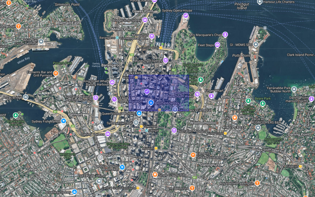
What Does Geohash Look Like?

Geohash divides the world into a grid of rectangles, as indicated in this portion of the world map.

Geohash

Use Cases of Geohash

Geohash is widely used for its simplicity and efficiency in spatial indexing, making it useful for a wide range of practical applications across industries.

  • Location-based searches
    Geohash is used in location-based search engines and applications, showing nearby points of interest, businesses, or places based on their current location or a specified area.
  • Geofencing
  • Geohash is employed to create geofences, or virtual boundaries, which can be used for triggering actions or alerts when a device or user enters or exits a specific geographic area, such as location-based marketing, asset tracking, security applications, social networking and even dating apps.
  • Mapping and cartography
    Geohash is used in cartography to represent geographic data efficiently. It can simplify the storage and retrieval of spatial information in mapping systems.
  • Digital adventures
    Users can connect with people and discover new destinations worldwide via apps which leverage geohashes to enhance travel journaling and social interactions, making global adventures more interactive and engaging.

These are just a few examples, and the applications of geohash continue to expand as location-based data becomes increasingly important across various domains.

The simplified representation of geographic coordinates makes geohash more accessible and user-friendly, which is why it is such a versatile geocoding system with a wide range of uses.

How Does Geohash Compare With Other Spatial Encoding Systems?

A geohash is one of many spatial encoding systems designed to represent geographic locations compactly and efficiently. Geohash can be substituted with alternative systems depending on the specific requirements of the application.

Each spatial encoding system is tailored to address particular needs, offering unique features and trade-offs that make some systems more suitable for specific use cases. For example, geohashes excel in simplicity and spatial indexing, while systems like H3 or Plus Codes may provide advantages in precision, scalability, or user-friendliness.

Read our blog which compares Geohash with H3>

Originally published: 26 September, 2023

Last updated: 26 November, 2024

Read more from The Proptech Cloud

Useful Websites for Australian Properties, Parcels and Addresses

Researching the existence of a property or verifying data can be challenging, often resulting in conflicting answers. Depending on your definition of a property, it may be necessary to visit various websites to validate property data.

Understanding Housing Affordability: Key Metrics and Statistics

Housing affordability is a significant concern in many parts of the world, affecting the quality of life and economic wellbeing of individuals and families.

To understand the dynamics of housing affordability we need to take a detailed look at a range of different metrics and statistics to gain a full picture.

The Three Primary Methods of Real Estate Data Integration

Learn the three primary methods of real estate data integration—geospatial relationships, title matches, and address matching—to improve accuracy, insights, and decision-making.

What’s the Difference Between GDA94 and GDA2020?

Geodetic datums, or geodetic systems, are often used by proptechs. Here is a rundown of everything you need to know about the different geodetic datums we use and reference in Australia.

Alternative Data: What Is It, Who Uses It And Why It Matters

Discover the powerful intel alternative data can offer. Learn why businesses and investors are turning to non-traditional data sources for deeper insights and smarter decisions.

What Is A Cadastre?

What Is A Cadastre?

Cadastres are used extensively in real estate and beyond. We break down what they are, how they’re stored, used and maintained in Australia.

Cadastre At A Glance (TL;DR)

A cadastre is an official record of land ownership, boundaries and value, crucial for property management, taxation and legal clarity.

Traditional cadastral systems relied on paper maps and manual record-keeping, whereas modern cadastres keep property data accurate, interactive and accessible.

Cadastres are often created and managed with technologies like Geographic Information System (GIS) which capture, store, analyse and visualise spatial or geographic data.

Around the world, innovations like 3D cadastres and digital platforms are enhancing how we manage, visualise and understand land data.

What Is A Cadastre?

A cadastre is a detailed register or database that holds information about land or property within a specific area. Each record in the cadastre defines the boundaries of a property, as mapped by land surveys. It also includes important details like the property’s location, features, and value.

A cadastre is an essential tool for managing and regulating land ownership and use. It helps with collecting property taxes, assessing land values, and resolving property disputes. It usually includes property boundaries, ownership details, and physical descriptions like size, shape, and terrain. It may also contain information on land use, zoning rules, building permits and environmental regulations.

What Does A Cadastre Look Like On A Map?

The way a cadastre is represented on a map can vary significantly depending on the source of the data and the configuration settings used in the mapping software. Different factors like styling, symbols, and labeling options can influence how the cadastre appears visually on the map.

The following image is a typical representation of cadastre on a map, showing boundary lines that delineate the various land parcels or lots. These boundary lines help visually separate one property from another. While lot numbers are used as an identifying label to provide a quick reference to specific parcels within the cadastre.

Cadastre represented on a map

Australian Cadastres

In Australia, individual state and territory governments are responsible for the maintenance of cadastres, rather than the federal government.

Each state and territory has its own land administration agency responsible for maintaining cadastres within their jurisdiction.

The following organisations maintain cadastres:

These agencies are responsible for updating and managing the cadastre, including recording changes to property ownership, boundaries, and other relevant information. They provide access to the cadastre and offer related services to the public, including title searches, property reports, and other land-related information.

What File Types Are Used To Store Cadastres?

These file types are commonly used to store a cadastre:

  • Shape file (.shp)
  • GDB (.gdb)
  • Geojson (.geojson)

File sizes of cadastre files can become quite large, depending on the extent of the coverage.

For example, the cadastre for New South Wales (NSW) in Australia is approximately 1.4 GB when compressed. Working with large files can be more manageable in cloud environments like Amazon Web Services (AWS). These cloud platforms provide substantial computing power that can be accessed when needed, then switched off in a pay-per-use model to more efficiently handle the processing requirements of large cadastre files.

Primarily spatial files, they contain geometry data that represents the boundaries of each land parcel within the cadastre. The geometry information can be stored and represented in various text formats, which are universally understood by spatial data software applications.

The most common approaches for storing and representing the geometries are

which ensure compatibility and ease of interpretation across different software tools and platforms.

Additional attributes relating to the cadastre can also be served within the same spatial file, such as through the properties key within a cadastre’s GeoJSON document. Other formats such as WKT or WKB do not support the direct inclusion of additional attributes to the geometry, but can be associated with in different ways such as in an accompanying csv file containing any additional attributes.

What Does A Cadastre Look In A Snowflake Marketplace Listing?

To incorporate a cadastre into Snowflake, it needs to be transformed into a table structure. The process involves loading the cadastre data in the form of GeoJson as a VARIANT data type in Snowflake. Then the GeoJson features are flattened and converted into individual rows within the table.

Alternatively, the cadastre file can be converted to a flat file outside of Snowflake, then loaded into Snowflake as you would with any other flat file.

This flattening process makes it easier to query and analyse the cadastre data using standard SQL operations within Snowflake, allowing for efficient storage, retrieval, and analysis of the information.

Attribute {A}Attribute {B}Attribute {C}Geometry
123POLYGON((30 10, 40 40, 20 40, 10 20, 30 10))

*The actual columns (feature attributes) available for each piece of land registered on a cadastre is dependent on the maintainer/publisher of the cadastre.

Who Provides Cadastres On The Snowflake Marketplace?

Here are a few providers of cadastres on the Snowflake Marketplace:

  • The Proptech Cloud
  • Geoscape
  • Precisely

How Are Cadastres Used?

Cadastres play a pivotal role in linking spatial data to real-world applications.

In the context of the built environment, cadastres serve a number of purposes, such as:

  • Identify the unique number of properties in a country,

  • Identify changes to properties (merges, subdivisions, title registrations),

  • Spatially link other spatial information to a property.

  • Spatially lookup a property based, i.e. lookup properties based on latitude and longitude coordinates, or based on geospatial shape (think drawing a circle on map to search for properties on the map).

  • Represent property boundaries on a map.

  • Assess property risks, develop climate change adaption strategies, evacuation routes and emergency responses.

  • Effective land use planning to guide urban development and expansion, the management of rural land resources and supporting environmental protection initiatives.

  • Planning and managing infrastructure projects, including tility networks.

The Future of Cadastres

Around the world, countries are adopting 3D cadastres to better capture the complexity of modern property landscapes.

For example, a collaborative project between Russia and the Netherlands explores how 3D models can improve the recording of rights associated with multi-level buildings, complex structures, and underground networks, such as gas pipelines.

The Netherlands has also developed 3D cadastre solutions to address the limitations of 2D cadastral maps in representing complex spatial property arrangements.

In Australia, the Australian CADASTRE 2034 strategy aims to create a fully digital, interoperable cadastre that can support various applications beyond traditional land administration.

As technology advances, so too does our ability to understand and shape the spaces in which we live and grow.

These advancements are an inspiring shift toward a future where cadastres will play a bigger role in urban planning, environmental management, and beyond.

Originally published: 25 September, 2023

Last updated: 19 November, 2024

Subscribe to our newsletter

Subscribe to receive the latest blogs and data listings direct to your inbox.

Read more from The Proptech Cloud

Useful Websites for Australian Properties, Parcels and Addresses

Researching the existence of a property or verifying data can be challenging, often resulting in conflicting answers. Depending on your definition of a property, it may be necessary to visit various websites to validate property data.

Understanding Housing Affordability: Key Metrics and Statistics

Housing affordability is a significant concern in many parts of the world, affecting the quality of life and economic wellbeing of individuals and families.

To understand the dynamics of housing affordability we need to take a detailed look at a range of different metrics and statistics to gain a full picture.

The Three Primary Methods of Real Estate Data Integration

Learn the three primary methods of real estate data integration—geospatial relationships, title matches, and address matching—to improve accuracy, insights, and decision-making.

What’s the Difference Between GDA94 and GDA2020?

Geodetic datums, or geodetic systems, are often used by proptechs. Here is a rundown of everything you need to know about the different geodetic datums we use and reference in Australia.

Alternative Data: What Is It, Who Uses It And Why It Matters

Discover the powerful intel alternative data can offer. Learn why businesses and investors are turning to non-traditional data sources for deeper insights and smarter decisions.

Top Property and Proptech Events in Australia 2025

Top Property and Proptech Events in Australia 2025

Upcoming Events in 2025

Explore Australia’s key property, real estate, contech, and proptech events for insights, networking, and industry trends.

These events provide valuable opportunities to learn from industry leaders, explore emerging technologies, and network with peers who are shaping the future of the sector.

If you’re looking to expand your knowledge, connect with others in the field, or uncover new business opportunities, these top events should be on your radar.

Here’s a list of Australia’s virtual and in-person industry events for the first half of 2025 so you can plan to make the most of what’s ahead.

Check back regularly as we add more confirmed events to the list.

PRRES Annual Conference

A formal focus for property researchers, educators, and practitioners across the Pacific-Rim region.

Hobart
12-15 January, 2025

$770 Early Bird

Digital Build World Summit

Digital transformation of infrastructure assets & the built environment.

Sydney
18-19 February, 2025

From $905+GST

Property Market Outlook - QLD

Insights into the how property will fare in 2025, hosted by Property Council of Australia.

Brisbane
13 February, 2025
12:00 – 14:30 AEST

$200

Property Market Outlook - NSW

Insights into the how property will fare in 2025, hosted by Property Council of Australia.

Sydney
13 February, 2025
12:00 – 14:30 AEST

$220

Alternative Real Estate Investment Summit

For institutional investors, fund managers and operators.

Sydney
4 March, 2025

From $395+GST

Malls of the Future Summit

Where retail, real estate and innovation converge.

Sydney
18-19 March, 2025

From $1,435+GST

Future of Office Summit

Investment opportunities, valuations and leasing strategies for Australia’s office market.

Melbourne
20 March, 2025

From $875+GST

Healthcare Real Estate Summit

Investment, development, construction and design strategies.

Sydney
6 May, 2025

To be announced

Sydney Build Expo 2025

Australia’s largest construction and design show.

Sydney
7-8 May, 2025

General Ticket – Free

Childcare & Early Learning Real Estate Summit

Investment, development, construction and design strategies.

Sydney
7-8 May, 2025

To be announced

Future of Construction Summit

Australia’s largest construction and design show.

Brisbane
20-21 May, 2025

To be announced

EV Infrastructure Summit

Powering the EV evolution.

Sydney
17-18 June, 2025

To be announced

Urbanity 2025

A conference for the creators of cities in the Asia-Pacific.

Gold Coast
29 – 31 July, 2025

To be announced

This blog is provided for informational purposes only. We are not affiliated with any of the events or providers mentioned. The information shared is intended to help readers stay informed and make their own decisions. Please verify details with the event organisers directly, as schedules and details may change.

Subscribe to our newsletter

Subscribe to receive the latest blogs and data listings direct to your inbox.

Read more from The Proptech Cloud

Useful Websites for Australian Properties, Parcels and Addresses

Researching the existence of a property or verifying data can be challenging, often resulting in conflicting answers. Depending on your definition of a property, it may be necessary to visit various websites to validate property data.

Understanding Housing Affordability: Key Metrics and Statistics

Housing affordability is a significant concern in many parts of the world, affecting the quality of life and economic wellbeing of individuals and families.

To understand the dynamics of housing affordability we need to take a detailed look at a range of different metrics and statistics to gain a full picture.

The Three Primary Methods of Real Estate Data Integration

Learn the three primary methods of real estate data integration—geospatial relationships, title matches, and address matching—to improve accuracy, insights, and decision-making.

What’s the Difference Between GDA94 and GDA2020?

Geodetic datums, or geodetic systems, are often used by proptechs. Here is a rundown of everything you need to know about the different geodetic datums we use and reference in Australia.

Alternative Data: What Is It, Who Uses It And Why It Matters

Discover the powerful intel alternative data can offer. Learn why businesses and investors are turning to non-traditional data sources for deeper insights and smarter decisions.

The Shifting Landscape of Property Ownership in Australia

The Shifting Landscape of Property Ownership in Australia

In Australia, there are different types of property ownership structures each with unique rights and responsibilities. From outright ownership and joint tenancy to tenants in common and trust ownership, each structure offers varying levels of control and liability.

However, with rising property prices, regulatory changes, and economic uncertainties, property ownership is evolving.

Relatively new, innovative models like shared equity schemes, build-to-rent and fintech-driven solutions address affordability and accessibility challenges, offering different pathways for those looking to invest in a dynamic property market.

Traditional Ownership Structures

When it comes to owning property in Australia, various ownership structures provide different rights and responsibilities to the owners.

  • Outright Ownership: In this structure, you are the sole owner of the property without any mortgage or debt, with your name alone on the deed. As the sole proprietor, you are fully responsible for the property, which is typically owned in your personal name.
  • Joint Tenants: Under joint tenancy, you and another person share equal ownership of the property. Both parties have full ownership rights, and upon the death of one joint tenant, their share automatically passes to the surviving joint tenant.
  • Tenants in Common: This structure allows two or more people to own specific portions of the property, which can be divided in any ratio, such as 50/50 or 70/30. Each owner has individual rights to their share, which they can sell or bequeath independently of the others.
  • Trust Ownership: Here, the property is owned and managed by a trust, an entity that holds assets on behalf of its beneficiaries. Family trusts are common in this structure, particularly when property is intended to be passed on to younger family members.
  • Company Ownership: Property can also be owned through a company, and there may be various taxes that could affect a business property.

Current Challenges in the Australian Property Market

Australian Housing and Urban Research Institute’s Report on Australian home ownership over the years shows that the Australian property market is facing significant challenges that are reshaping how people approach property ownership.

Affordability

Rising property prices and stagnant incomes have made traditional home ownership increasingly difficult for many Australians, particularly younger and lower-income households.

Over the past decades, the ability of individuals aged 24–45 to purchase homes has diminished, contributing to a long-term demographic trend of lower ownership rates.

The lack of significant income growth limits the ability to save for deposits or qualify for mortgages, intensifying the impact of high property prices.

Rising rents in recent times also forces renters to allocate a larger portion of their income to rent, making it more challenging for them to save for a deposit to purchase a home.

Housing Supply and Demand Imbalances

The mismatch between housing supply and demand is another significant challenge.

The construction industry is increasingly focused on multi-unit dwellings designed for the rental market, particularly in major Australian cities.

These properties tend to cater to investors and renters rather than potential homeowners, reflecting an industry recognition that ownership may not be the primary mode of housing growth in the future.

Economic Uncertainty

Factors such as interest rates and inflation influence property ownership trends by affecting borrowing capacity and investment decisions.

Stagnant incomes, alongside a mismatch between housing supply and demand, has further strained affordability.

Regulatory and Policy Environment

The policy environment has not supported a resurgence in homeownership. Instead, there is a strong push toward supporting rental markets and investment properties (such as oppositions to negative gearing reform and the build-to-rent push), partly due to the influence of financial and property development lobby groups.

By contrast, there are not equivalent lobbying interests for home purchase.

Global Context and Future Outlook

The decline in homeownership is not unique to Australia, but part of a broader trend seen in many developed countries. As policies and market conditions evolve, there is a noticeable shift from promoting homeownership to managing rental markets.

This trend seems to suggests that Australia’s housing landscape may continue to favour rental and investment properties over traditional homeownership, which means new approaches to housing policy and economic support for potential homeowners is required.

Costs of Changing Property Ownership

In addition to the above challenges, the change of property ownership incurs various costs in Australia, which adds to the cost of home ownership:

    • Stamp Duty: A government tax payable when purchasing property. It is charged as a percentage of the land valuation, typically between 3% and 5.5%, depending on the state.
    • Capital Gains Tax (CGT): If you sell property or assets for more than its purchase price, you incur a capital gain and must pay tax on it; if you sell for less, you incur a capital loss. Applicable to assets purchased on or after 20 September 1985, CGT is 25% but is exempt for primary residences. Investment properties sold after 12 months of ownership qualify for a 50% CGT discount.
    • Other Fees: Legal fees, valuation fees, and costs relating to real estate agent, property marketing, moving and/or changes in existing mortgages may also apply.

These compounding issues have given rise to innovative property ownership models, driving buyers towards new ways of getting onto the property ladder.

Meeting Market Demands

The challenges of the Australian property market have spurred the development of unconventional ownership models that reflect the realities of modern buyers and offer an alternative to the more traditional ideals of property ownership.

Here we discuss alternative ownership models and schemes growing in popularity.

Collaborative Models

As discussed, there are a few options for traditional joint ownership of a property, with different legal ownership structures allowing multiple parties to jointly or partially own property.

Alternative collaborative models, however, are gaining popularity as it leverages collective buying power of their members when they allow multiple parties to share the costs and benefits of owning property. Examples include fractional investing or fractional ownership, where investors own a fraction of a property, and housing cooperatives.

These models are often facilitated through digital platforms that handle everything from matching co-owners (such as Mortgage Mates and Co-operty) to managing legal agreements (such as Rundl).

Shared Equity Schemes

A shared equity scheme is where buyers purchase a portion of a property and the remaining share is owned by an investor or the government.

Examples include the nationwide Help to Buy Program where the government contributes 40% for new builds and 30% for existing properties.

With the exception of the Northern Territory, variations of these shared equity schemes are offered in each state and territory across Australia.

These schemes lower the financial barrier to entry, enabling more people to own property, even if it’s only a partial equity ownership stake.

Build-To-Rent

Build-to-rent model involves developers retaining ownership of residential properties and leasing units directly to tenants, rather than selling them individually.

While it does not promote individual homeownership, build-to-rent provides several benefits that address common issues faced by renters. Tenants enjoy long-term leases, which provide greater security and the opportunity to build a stable home environment. This model also allows for more flexibility, such as the freedom to personalise living spaces, keep pets and access a range of communal amenities that enhance the quality of life, such as gyms, co-working spaces and social areas.

By focusing on long-term rental solutions, build-to-rent developments aim to create vibrant communities where residents feel a strong sense of belonging and stability, catering to those who prioritise convenience and flexibility by offering a more high-quality, stable and secure rental experiences compared with traditional renting options.

Rent-To-Buy (also known as Rent-To-Own or Vendor Financing)

In theory, rent-to-buy models make home ownership more accessible by offering a “live now, buy later” concept as an answer to those struggling to save a large deposit in Australia’s high-priced housing market.

Typically, the rent-to-buy model allows prospective homeowners to move into a property and live there. Instead of requiring a substantial deposit upfront, this model enables tenants to rent the property and gradually accumulate their deposit as part of their rental payments.

Once the deposit is fully accrued, the tenant can transition to full ownership. FrontYa and PublicSquare offer variations of the rent-to-own model with pathways for potential homeowners to rent a property with the option to purchase it later.

The Synergy Between Fintech and Proptech Driving New Property Ownership Models

The collaboration between fintech and proptech has created a synergy that has driven the development of some new property ownership models by facilitating key processes.

The Rise of Fintech in Property Ownership

One of the most significant shifts has been the integration of financial technology (fintech) into the property market. Fintech companies are transforming how people finance their property purchases, offering more flexible and accessible lending options.

Online platforms now streamline the mortgage application process, providing instant pre-approvals and personalised loan offers based on real-time data, making it easier for buyers to secure financing even in a challenging economic environment.

Fintech has also introduced alternative financing models, such as peer-to-peer lending and crowdfunding.

These platforms allow individuals to invest in property collectively, breaking down barriers for those who might not have the capital to purchase property outright. By pooling resources, investors can own a share of a property and earn returns without traditional mortgages.

Proptech: Revolutionising the Real Estate Industry

Alongside fintech, the emergence of property technology (proptech) is transforming how properties are bought, sold and managed.

Proptech encompasses a wide range of digital tools and platforms designed to enhance every aspect of the real estate process.

Typically, fintech drives these modern property ownership models by providing financial tools and platforms that simplify transactions, expedite processes and enhance transparency.

Proptech complements them by delivering the digital infrastructure and solutions that streamline operations, making these models both accessible and easy to manage.

Innovation and Legal Uncertainty: The Evolving Cycle

Fintech and proptech companies are driving technological innovation and digital disruption across the real estate industry.

However, these advancements also expose the limitations of current regulations.

For example, rent-to-buy and rent-to-own schemes often fall into gaps between federal and state laws, as highlighted by the Consumer Action Law Centre. This unfortunately leaves consumers without the same legal protections that standard home loan borrowers receive.

The scarcity of publicly available information about these new ownership schemes—such as details on conditions, fees, taxes, risks and stakeholder rights—can limit consumers who are conducting due diligence before making any decisions, adding to borrower risk.

To tackle these challenges, proposed laws aim to protect vulnerable stakeholders from risky schemes and regulate against unscrupulous providers.

The relationship between innovation and regulation is constantly evolving, requiring a careful balance between fostering technological advancements, ensuring consumers are protected and that the market is fair.

The Future of Property Ownership in Australia

As these technologies and models continue to evolve, they are not only addressing the current challenges of the Australian property market but are also laying the groundwork for the future. The real estate industry is increasingly interconnected with the broader tech ecosystem, leading to more seamless and integrated property experiences.

In the coming years, we can expect further advancements in fintech and proptech, with innovations that continue to push the boundaries of what’s possible in property ownership and investment. From AI-driven market predictions to blockchain-secured transactions, the future of property ownership in Australia looks set to be more digital, more accessible, and more dynamic than ever before.

This shift toward digitalisation and technological disruption reflects a broader trend across industries, where technology is leveraged to solve complex challenges and create new opportunities. In the property market, this means more options for buyers, and ultimately, a more resilient and adaptable real estate industry that can better meet the needs of a changing world.

For expert help navigating title changes and property ownership questions, consider speaking to a conveyancer or solicitor. They can assist with issues related to property ownership and property law.

All content provided is for informational purposes only. While we strive to ensure that the information provided here is both factual and accurate, we make no representations or warranties of any kind about the completeness, accuracy, reliability, suitability, or availability with respect to the blog or the information, products, services, or related graphics contained on the blog for any purpose.

Subscribe to our newsletter

Subscribe to receive the latest blogs and data listings direct to your inbox.

Read more from The Proptech Cloud

Useful Websites for Australian Properties, Parcels and Addresses

Researching the existence of a property or verifying data can be challenging, often resulting in conflicting answers. Depending on your definition of a property, it may be necessary to visit various websites to validate property data.

Understanding Housing Affordability: Key Metrics and Statistics

Housing affordability is a significant concern in many parts of the world, affecting the quality of life and economic wellbeing of individuals and families.

To understand the dynamics of housing affordability we need to take a detailed look at a range of different metrics and statistics to gain a full picture.

The Three Primary Methods of Real Estate Data Integration

Learn the three primary methods of real estate data integration—geospatial relationships, title matches, and address matching—to improve accuracy, insights, and decision-making.

What’s the Difference Between GDA94 and GDA2020?

Geodetic datums, or geodetic systems, are often used by proptechs. Here is a rundown of everything you need to know about the different geodetic datums we use and reference in Australia.

Alternative Data: What Is It, Who Uses It And Why It Matters

Discover the powerful intel alternative data can offer. Learn why businesses and investors are turning to non-traditional data sources for deeper insights and smarter decisions.

Parcels, Titles, Addresses and Properties. What’s The Difference?

Parcels, Titles, Addresses and Properties. What’s The Difference?

“Parcels”, “titles”, “addresses” and “properties” are often used interchangeably in real estate, but they refer to distinct concepts.

Understanding the differences between these terms is essential, particularly when dealing with land transactions, property ownership, or legal documentation.

We discuss it here.

The Definitions and Differences Between Parcels, Titles, Addresses and Properties

We define each of these terms in the context of Australian real estate. Additionally, we’ll explore how these terms are interlinked, while highlighting the key differences that set them apart.

What is a Parcel?

A Parcel refers to a specific section of land within a larger property. Think of it as a defined portion of land with clear boundaries, often identified by a unique number for legal or administrative purposes. Parcels are essential for land registration and property management.

In some Australian states, such as New South Wales (NSW), a parcel may also be referred to as a Lot and Plan, which serves as its identification number.

Properties can include multiple parcels. For example, a farm might consist of several individual parcels, but all these parcels are sold together when the property is transferred to a new owner.

What is a Title Reference or Volume Folio?

The Volume Folio or Title Reference is a unique identifier assigned to a property title (a legal document that records specific information about a property) in the Australian land registration system. It represents the registered ownership and legal description of a property.

  • The Volume refers to the specific book or register where the property title is recorded.
  • The Folio refers to the page or entry in that volume where the property information is found.

This unique identifier plays a crucial role in land transactions and legal documentation, ensuring properties are accurately identified.

When you hear someone refer to a “Volume Folio,” they are pointing to the formal documentation that confirms a property’s legal ownership.

What is an Address?

An Address is what we commonly use to describe the physical location of a property.

It consists of separate elements such as:

  • Street number
  • Street name
  • Suburb
  • State
  • Postcode

Addresses serve practical purposes, such as mail delivery, and are a key element in identifying a property’s physical location.

However, a property can sometimes have more than one address. For instance, corner lots or properties with access from back lanes may have multiple addresses.

What is a Property?

The term Property can have different meanings depending on the context. Within state government titling systems, a property refers to a piece of land that can be bought and sold.

In this context:

  • A property may consist of one or more parcels.
  • It may have one or more addresses.
  • It is recorded with a Volume Folio.

Understanding this broader definition helps clarify why “property” can be a complex term to define. For more details, check out our blog, What is a Property, where we dive deeper into the nuances of defining property in various contexts.

Common Questions

Can a parcel appear on more than one volume folio?

No, a parcel typically cannot appear on more than one Volume Folio. In the Australian torrens title system maintained by each state, each parcel of land is associated with a single Volume Folio. This folio contains the registered ownership and legal details of that specific property. However, there are exceptions where some states have titles that share a common parcel, like the Northern Territory and Unit Titles.

Are addresses unique?

In theory, addresses should be unique, but in practice, there can be exceptions.

Several factors can lead to address duplication or confusion, such as:

  • Unit addresses: Sometimes unit numbers are left out, making it difficult to distinguish between multiple units in the same complex.
  • Rural addresses: Properties without a public road frontage or properties identified by a name rather than a street number may cause complications.
  • Multi-building complexes: In some cases, the same unit number can appear in different buildings within the same complex, especially if building names are omitted.

Why Understanding the Differences Between These Terms Matters

Understanding the distinctions between properties, parcels, titles, and addresses is essential for ensuring accuracy and clarity, particularly when it comes to land transactions and property ownership.

For further research on Australian properties, parcels, volumes, and folios, check out our recommended resources in the article, Useful Websites for Australian Properties, Parcels and Addresses.

Originally published: 17 July 2023

Last updated: 15 October 2024

Read more from The Proptech Cloud

Useful Websites for Australian Properties, Parcels and Addresses

Researching the existence of a property or verifying data can be challenging, often resulting in conflicting answers. Depending on your definition of a property, it may be necessary to visit various websites to validate property data.

Understanding Housing Affordability: Key Metrics and Statistics

Housing affordability is a significant concern in many parts of the world, affecting the quality of life and economic wellbeing of individuals and families.

To understand the dynamics of housing affordability we need to take a detailed look at a range of different metrics and statistics to gain a full picture.

The Three Primary Methods of Real Estate Data Integration

Learn the three primary methods of real estate data integration—geospatial relationships, title matches, and address matching—to improve accuracy, insights, and decision-making.

What’s the Difference Between GDA94 and GDA2020?

Geodetic datums, or geodetic systems, are often used by proptechs. Here is a rundown of everything you need to know about the different geodetic datums we use and reference in Australia.

Alternative Data: What Is It, Who Uses It And Why It Matters

Discover the powerful intel alternative data can offer. Learn why businesses and investors are turning to non-traditional data sources for deeper insights and smarter decisions.