The Significance of Land Titles Searches in Australia

The Significance of Land Titles Searches in Australia

Understanding property ownership is crucial when it comes to the process of buying or selling real estate.

One of the fundamental steps in this process is conducting a land title search.

We’ll explore the significance of land title searches and provide an overview of the process involved.

Why are land title searches important?

A land title search is an important part of any property transaction because it provides essential information about a property’s ownership, history and its legal status. Visibility into a property could surface any potential challenges and offer peace of mind.

Land title searches provide:

  • Ownership verification: A title search helps confirm the current property owner, and ensures that the seller has the legal right to transfer ownership.
  • Encumbrances: It reveals any liens, mortgages, or other encumbrances on the property. These could affect your ability to buy or sell the property.
  • Property boundaries: The search may include information on property boundaries, so you know exactly what you’re potentially buying.
  • Legal issues: Uncovering legal disputes or pending litigation related to the property is important to avoid potential future headaches.
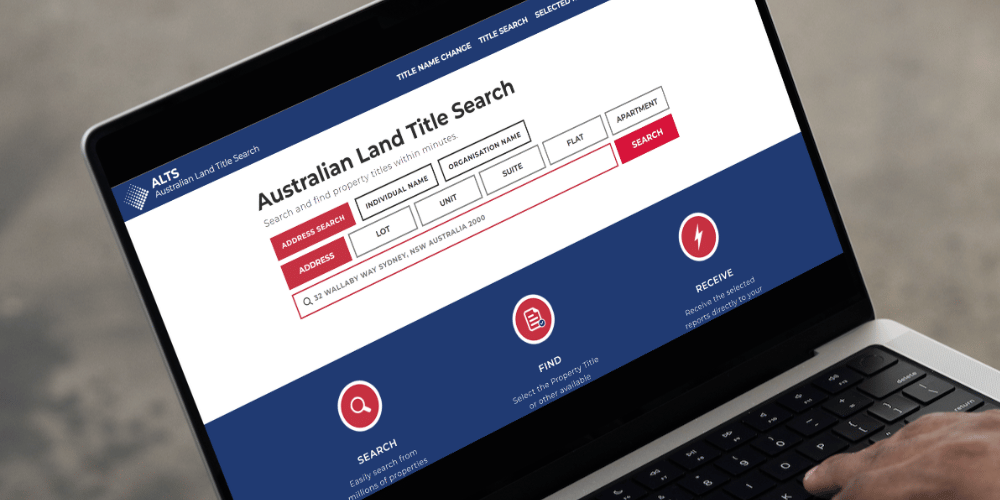
Land title search

How land titles are managed and regulated

Land titles in Australia are managed and regulated at the state and territory level, with each jurisdiction having its own specific legislation and system for registering and managing land ownership.

  • Torrens Title System: Most land in Australia is governed by the Torrens Title System. This system provides a government-guaranteed title, offering security and certainty of ownership. When you own a property under Torrens Title, your name is recorded on the land title register, and you receive a Certificate of Title as evidence of your ownership.
  • Land Titles Offices: Each state and territory in Australia has its Land Titles Office or equivalent authority responsible for maintaining and registering land titles. These offices are responsible for recording all land transactions, including property sales, mortgages, and leases.
  • Transfer of Ownership: When you buy or sell a property, a legal process known as conveyancing occurs. This process involves transferring the ownership of the property from the seller to the buyer. Conveyancers or solicitors typically handle this process, ensuring that the transfer is legally valid and registered with the Land Titles Office.
  • Certificate of Title: The Certificate of Title is an important document that proves ownership of the property. It includes information about the property, such as its boundaries and any restrictions or encumbrances. In some states, this document is now stored electronically, and a paper certificate may not be issued.
  • Encumbrances and Easements: The land title register also records any encumbrances or easements that may affect the property. These could include restrictions on land use, rights of way, or access for utilities. It’s essential to understand these when buying a property.
  • Land Title Searches: Anyone can conduct a land title search, which provides information about a property’s title, ownership, encumbrances, and other relevant details. This is most commonly done during the due diligence process when purchasing property.
  • Transfer of Land Fees and Stamp Duty: When transferring ownership of a property, you’ll be required to pay fees to the Land Titles Office. Additionally, you may need to pay stamp duty, which is a state or territory tax based on the property’s purchase price.
  • Land Title Fraud Protection: Australian Land Titles Offices have implemented various measures to protect against fraud, including electronic conveyancing systems and identity verification processes.
  • Leasehold and Strata Titles: In addition to Torrens Title, some properties may have leasehold titles (common in some rural areas) or strata titles (for multi-unit buildings). These titles have their specific regulations and requirements.
Australian Land Title Search

Land title search must-knows

Accessing land title information

In Australia, land title information is usually managed at the state or territory level by government agencies. Each state and territory has its own land titles office or equivalent agency. Property information, including title records, can often be accessed online through these government websites or in person at their offices.

Property identification

To conduct a land title search, you typically need to provide specific details about the property, such as its address, lot and plan number, or title reference. This information is used to identify the property in the land titles database.

Requesting a search

You can request a land title search by filling out a form and paying a fee. Some government agencies also offer online search services where you can enter the property details and pay for the search online.

Types of land title searches

    • Current Title Search: Provides information about the current property owner, any mortgages or liens, and property boundaries.
    • Historical Title Search: Offers historical data on the property, including past ownership, transfers, and historical titles.
    • Encumbrance Search: Shows any encumbrances or restrictions on the property, such as easements, covenants, or caveats.
    • Plan and Survey Searches: Provide access to survey plans and related documents, which can be important for boundary and development information.

Search results

Once your search request is processed, you will receive a report or certificate that summarises the information available for the property. This report will include details about the property’s current owner, any encumbrances, and other relevant information.

Procedures and access

Methods of conducting land title searches may vary slightly between different states and territories in Australia. We recommend you check the specific land titles office or agency for each state or visit their official website (see Property Registry) for up-to-date and detailed information on conducting land title searches in Australia.

Land title search

Who might conduct title searches?

Land title searches are commonly completed to gain essential information before buying or selling a property, conduct due diligence, or settle legal matters related to land and property. Typically, a title search is done by:

  • Prospective buyers often perform a land title search to check that the property they intend to purchase has a clear title, free from any legal issues or encumbrances.
  • Sellers may choose to conduct a title search to confirm the accuracy of the property’s ownership records and to address any potential issues before listing the property for sale.
  • Real estate agents may assist buyers and sellers in conducting land title searches as part of their services. They can help facilitate the process and ensure that their clients have a full understanding of the property’s title status.
  • Real estate attorneys often conduct title searches as part of their due diligence when representing buyers or sellers in property transactions. They can identify and address legal issues that may affect the transaction.
  • Title companies specialise in providing title insurance and conducting title searches. They have access to comprehensive databases and can perform thorough searches to verify property ownership and identify any liens or encumbrances.
  • Mortgage lenders may also require a title search as part of the loan approval process to protect their interests and ensure that the property can be used as collateral for the loan.
  • In some cases, government agencies or land registries may be involved in title searches, especially when dealing with public lands or properties owned by government entities.

Read more from The Proptech Cloud

Alternative Data: What Is It, Who Uses It And Why It Matters

Discover the powerful intel alternative data can offer. Learn why businesses and investors are turning to non-traditional data sources for deeper insights and smarter decisions.

What Is A Geohash And How Is It Used?

Discover what a geohash is, how it works, and its real-world applications in mapping, logistics and data analysis.

What Is A Cadastre?

Learn how cadastres capture property boundaries, ownership details, and values, and see how technology is transforming them with 3D models, GIS and digital platforms.

Top Property and Proptech Events in Australia 2025

These industry events provide valuable opportunities to learn from industry leaders, explore emerging technologies, and network with peers who are shaping the future of the sector.

The Shifting Landscape of Property Ownership in Australia

Uncover the ways in which fintech and proptech are revolutionising property ownership in Australia, making it more accessible and dynamic than ever before.

Top 11 Uses for Weather Data in Real Estate

Top 11 Uses for Weather Data in Real Estate

Weather data plays a significant role in many facets of real estate.

Businesses involved at each stage of the property lifecycle across a range of industries and professions use weather data, together with other key data points, to make important strategic decisions.

Here we highlight the top 11 property-related processes where weather data serves as a valuable tool and why.

Zoning and land use

1. Zoning and Land Use

Government bodies and local councils consider weather data in planning decisions about zoning, development and land use to ensure the safety, sustainability, and functionality of urban areas. Examples include flood risk assessment, to avoid and manage heat islands, wildfire risk assessments, infrastructure resilience and emergency preparedness.

2. Location Selection, Urban Planning and Development

Urban planners and developers use historical data to make informed decisions about where to build new properties and infrastructure.

This data can help them identify areas with low risk of natural disasters and favourable climate conditions, which can impact liveability and attract more buyers and tenants.

Similarly, real estate developers and businesses considering new locations could use this data to make informed decisions about where to invest. Climate considerations affect the attractiveness of a location for both residential and commercial purposes. Investors in real estate often rely on historical data to formulate their investment strategies.

3. Building Design

Weather data has a substantial influence on building design and the choice of materials when creating structures that are not only functional but also durable, energy-efficient, and comfortable.

Heating and cooling, orientation, precipitation, weather events, energy efficiency and sustainability are just a handful of the factors considered by architects, engineers, and construction professionals in building design.

As weather patterns develop, longer-term planning of climate resilient developments that can withstand climate changes will rely on historical weather trends and patterns.

Weather data influences building design

4. Construction Planning and Forecasting

Weather data is used very broadly in building construction.

Project scheduling of weather dependent tasks and site preparations; optimising resources, tradespeople and equipment; safety planning; the handling, logistics and protection of construction materials; environmental compliance all factor into construction planning and building contractual agreements.

Weather has such a profound impact on productivity and safety in the construction industry that a host of construction software, apps and technologies have emerged to improve the efficiency of planning, communication and management procedures and build resilience. And the companies developing this construction software incorporate weather data!

An example is UBIMET, an organisation specialised in high-precision meteorology and international weather services. Their range of offerings include weather solutions that allow construction companies to make informed decisions about their development projects.

5. Innovative Data-Based Engineering and Concept Designs

Weather data could be used in research and development, design or data-driven engineering (a framework for a new approach to technical product development), particularly of smart products in our built environment.

Engineers and designers can use this data to help plan, redesign and improve the design process and verify design concepts¹.

Smart products in the built environment
Seasonal property demand is influenced by weather

6. Seasonal Property Demand

At a simplistic level, weather data can help predict seasonal fluctuations in property demand, both in purchase and rental.

Real estate agents, and holiday rental marketers often use this data to target regions, seasons, highlight favourable weather conditions and seasonal attractions when promoting properties and timing campaigns.

For instance, a beachfront property may be marketed with historical or even real-time weather data showcasing sunny days and warm temperatures.

7. Property Protection, Maintenance and Repairs

Property managers may reference historical data to safeguard properties, anticipate environmental wear and tear, and gauge maintenance and repair needs, particularly in regions with higher risks of severe or extreme weather incidences.

Weather data is crucial in assessing suitability of land for agricultural purposes

8. Agricultural Real Estate

In rural areas, weather data is crucial for assessing the suitability of land for agricultural purposes.

Historical data can provide insights into factors like rainfall patterns, temperature ranges, and frost dates, which are vital for farming and land use decisions.

9. Risk Assessment

Weather and climate risk impacts all real estate assets in a broad sense. Weather data can help assess the potential risks associated with a property.

Historical data allows buyers, sellers, and investors to make informed decisions regarding property investments by understanding the past occurrences and potential risks.

Real estate risk assessments influence building design and construction; investor and asset manager decisions; insurance industry processes; banking and home loans; government resourcing and funding of community assistance services, policies and programs, just to name a few.

It has also given rise to a host of proptech tools, which ingest this weather data, to help stakeholders assess the risk to their real estate assets. An example of a climate risk report tool is ClimateCheck, and The World Bank offers climate and disaster risk screening tools designed to build resilience measures into project design.

Weather data plays a role in the valuation of property

10. Property Valuation

Historical weather data, among other factors, impact property prices and property valuation. While it may not be the sole determinant of property value, it can influence valuations, particularly in areas of weather-related risks.

And weather conditions can also impact insurance costs, desirability, liveability and saleability. Banks, real estate agents, government bodies and councils, property developers and investors are amongst those who would have a vested interest in the valuation of a property.

11. Insurance Planning

Weather data is vital for insurance planning.

Property owners or tenants rely on historical weather data to assess the risk of damage from weather-related incidents such as storms, flooding, or wildfires. This information can help them choose the right insurance coverage and understand potential insurance costs.

On the flip side, insurance companies use weather data to analyse and assess the risk when calculating premiums associated with insuring a property. Data analytics of weather information could also assist as a tool in identifying potential fraudulent cases.

Weather data has a versatile range of uses and plays a crucial role in all areas of the property lifecycle.

And judging by the range of weather intelligence software in market, weather data also plays a crucial role in software development to aid a wide range of industries, not just in real estate.

Weather data not only enhances property-related decisions but also fuels innovation in proptech, ushering in a new era of data-driven solutions that may help guide the buying, selling, construction and management of properties.


Source:
¹Ang Liu , Yuchen Wang , Xingzhi Wang, (2022) Data-Driven Engineering Design, Switzerland: Springer Cham

Weather Data Listings

The Proptech Cloud curates a range of weather data listings for use in real estate processes and analysis.

Subscribe to our newsletter

Subscribe to receive the latest blogs and data listings direct to your inbox.

Read more from The Proptech Cloud

Alternative Data: What Is It, Who Uses It And Why It Matters

Discover the powerful intel alternative data can offer. Learn why businesses and investors are turning to non-traditional data sources for deeper insights and smarter decisions.

What Is A Geohash And How Is It Used?

Discover what a geohash is, how it works, and its real-world applications in mapping, logistics and data analysis.

What Is A Cadastre?

Learn how cadastres capture property boundaries, ownership details, and values, and see how technology is transforming them with 3D models, GIS and digital platforms.

Top Property and Proptech Events in Australia 2025

These industry events provide valuable opportunities to learn from industry leaders, explore emerging technologies, and network with peers who are shaping the future of the sector.

The Shifting Landscape of Property Ownership in Australia

Uncover the ways in which fintech and proptech are revolutionising property ownership in Australia, making it more accessible and dynamic than ever before.

The Role of Data in Real Estate Decisions

The Role of Data in Real Estate Decisions

Businesses use a wide range of data to confidently analyse trends, forecast changes, and identify opportunities. In today’s competitive real estate industry, the data behind informed business decisions can be the difference between success and failure.

Why is data-driven decision-making so important in real estate?

With the advent of big data and accessibility of data, companies are now able to make more accurate and strategic decisions by analysing information, key trends and metrics. Data-driven decision-making has become critical in real estate because it allows businesses to identify opportunities, reduce risks and maximise returns on investments.

Using data in real-estate decisions

Some examples may include:

  • Real estate investment decisions

    Real estate and related data as diverse as historical sales data, demographics, market demand, property valuations can be used to identify profitable investment and development opportunities, determine a value of a property and assess potential returns on property investments.

  • Retail analytics

    Property data together with foot traffic data, demographics, sales data, can play a role in location selections and market expansion decisions. It will also influence merchandising decisions such as retail promotions and campaigns, product placement, store layout and inventory management.

  • Real estate sales decisions

    By analysing current and historical market trends, businesses can determine optimal pricing strategies for properties. Similarly demographic data can be used to identify the target audience for a particular property and inform advertising and marketing efforts.

  • Mortgage and financing decisions

    For risk assessments, lenders use property data to evaluate the value and condition of collateral for mortgage loans, determining loan eligibility and interest rates.
    On the flipside, credit scoring models may incorporate property data to evaluate borrower creditworthiness.

  • Government and urban planning

    Urban planners use property data to identify areas in need of infrastructure development, such as roads, schools, and utilities. Governments may use property data to enforce zoning regulations and property tax assessments.

  • Building and construction planning

    Property data aids in estimating construction costs, project timelines, and feasibility studies.

  • Insurance underwriting and claims

    Insurers consider property data when determining premiums and coverage for homeowners and property insurance policies. Property data may play a role in processing claims by verifying property details and assessing damage.

  • Environmental impact assessment

    Property, environmental, regulatory and geospatial data may all factor into decisions made concerning property projects.

Tips for interpreting and analysing property data

While data-driven decision-making is a valuable tool in real estate, it is important to understand how to properly analyse and interpret property data.

Here are some tips to keep in mind:

  • Data Accuracy

    Ensure the data you’re using is accurate and up-to-date. Rely on reputable sources and verify the information where possible.

  • Compare and Contrast

    Don’t make decisions based on a single data point. Compare property data from different sources and periods to identify trends and outliers.

  • Consider Context

    Understand the broader economic and market context in which the data exists. External factors like interest rates, local regulations, and economic conditions can significantly impact real estate data.

  • Data Visualisation

    Utilise data visualisation tools to transform complex data sets into easy-to-understand graphs and charts. Visual representations can highlight patterns and trends.

  • Consult Experts

    When in doubt, seek advice from experienced proptech professionals or data scientists and analysts. They can provide valuable insights and guidance in interpreting property data effectively.

  • Human Judgement

    Don’t ignore intuition and personal experience entirely. Data is important, but it should be used to inform decisions, not replace human judgement.

As we’ve explored, various types of data play a pivotal role in shaping business decisions. In an era of big data and accessible information, real estate professionals have the tools at their disposal to analyse trends, forecast changes, and seize opportunities like never before.

Businesses can navigate the intricate terrain of real estate with greater precision, with data illuminating the path.

Human judgment and expertise are still indispensable. Seek out experts, draw from your intuition, and let data guide your decisions, not dictate them.

    Read more from The Proptech Cloud

    Alternative Data: What Is It, Who Uses It And Why It Matters

    Discover the powerful intel alternative data can offer. Learn why businesses and investors are turning to non-traditional data sources for deeper insights and smarter decisions.

    What Is A Geohash And How Is It Used?

    Discover what a geohash is, how it works, and its real-world applications in mapping, logistics and data analysis.

    What Is A Cadastre?

    Learn how cadastres capture property boundaries, ownership details, and values, and see how technology is transforming them with 3D models, GIS and digital platforms.

    Top Property and Proptech Events in Australia 2025

    These industry events provide valuable opportunities to learn from industry leaders, explore emerging technologies, and network with peers who are shaping the future of the sector.

    The Shifting Landscape of Property Ownership in Australia

    Uncover the ways in which fintech and proptech are revolutionising property ownership in Australia, making it more accessible and dynamic than ever before.

    What’s the Difference Between GDA94 and GDA2020?

    What’s the Difference Between GDA94 and GDA2020?

    Geodetic datums, or geodetic systems, are often used by proptechs. Here is a rundown of everything you need to know about the different geodetic datums we use and reference in Australia.

    What is a geodetic datum?

    A geodetic datum is a set of reference points and parameters used to define the shape and orientation of the Earth’s surface for mapping and surveying purposes. It provides a coordinate system that allows locations on the Earth’s surface to be accurately described and located. In Australia, we use Geodetic Datum of Australia 1994(DA94) and Geodetic Datum of Australia 2020 (GDA2020).

    History of Australia’s geodetic datums

    Prior to GDA94, Australian surveyors primarily used the Australian Geodetic Datum 1966 (AGD66), which was based on a network of ground-based survey points and astronomical observations.

    AGD66 was the standard datum used for mapping and surveying in Australia for several decades until it was superseded by GDA94 in the 1990s.

    The decision to switch to GDA94 was driven by the need for a more accurate and up-to-date geodetic datum that could take advantage of advances in geospatial technology such as GPS. AGD66 was also affected by tectonic movements and other changes in the Earth’s surface, which made it increasingly difficult to use for accurate positioning and navigation.

    GDA94 (Geocentric Datum of Australia 1994) was the geodetic datum used in Australia from 1994. Based on a mathematical model of the Earth’s surface defined using measurements from a network of ground-based survey points, and used as the standard datum for mapping and surveying in Australia.

    Now, GDA2020 (Geocentric Datum of Australia 2020) is the current geodetic datum used in Australia. It was introduced in 2017 to replace GDA94 and is based on more recent measurements of the Earth’s surface using advanced satellite and ground-based technology.

    GDA2020 provides a more accurate representation of the Earth’s surface than GDA94, and is designed to be compatible with global positioning systems (GPS) and other modern geospatial technologies.

    Even though AGD66, and to some extent GDA94, are no longer the primary datums used in Australia, it’s still important to maintain historical data that was referenced to this datum. It is possible to transform data from AGD66 to GDA94 or GDA2020 using appropriate transformation parameters to ensure compatibility and accuracy when comparing or integrating data from different sources.

    Conversions between geodetic datums

    Conversions between AGD66 and GDA94 are not 100% accurate, because the two datums are based on different mathematical models of the Earth’s surface with different reference points and parameters.

    To convert data from AGD66 to GDA94 (or vice versa), a mathematical transformation must be applied that takes the differences between the two datums into account. This transformation involves adjusting the latitude, longitude, and height values of the data to align with the new datum.

    However, there are many factors that can affect the accuracy of this transformation, such as:

    1. The quality and accuracy of the original data: If the original data was collected using imprecise or inaccurate methods, the transformation may introduce additional errors or inaccuracies.
    2. The complexity of the transformation: Some transformations may require more complex mathematical models or additional parameters to be specified, which can increase the likelihood of errors.
    3. The location and terrain of the data: The accuracy of the transformation can vary depending on the location and terrain of the data. Some areas may be more affected by tectonic movements or other changes in the Earth’s surface, which can make the transformation more challenging.
    4. The type of data being transformed: Different types of data (e.g. points, lines, polygons) may require different transformation methods or parameters, which can affect the accuracy of the transformation.

    While conversions between AGD66 and GDA94 can be relatively precise, they’re not 100% accurate. This is due to the inherent differences between the two datums, and the potential for errors or inaccuracies in the transformation process. It’s important to use appropriate transformation methods and understand the limitations and potential sources of error when converting data between different geodetic datums.

    The difference between GDA94 and GDA2020

    The key differences

    The main difference between GDA94 and GDA2020 is their accuracy and the methods used to define them. GDA2020 is a more accurate and up-to-date datum, with improvements in the modeling of the Earth’s surface that take into account changes in its shape over time. This means that positions and distances measured using GDA2020 are more accurate than those measured using GDA94. Additionally, GDA2020 is designed to be compatible with modern geospatial technologies and is expected to be used for many years to come.

    It’s worth noting that the difference between GDA94 and GDA2020 may not be significant for many applications, particularly those that don’t require high levels of accuracy. However, for applications that require precise positioning or measurement, such as surveying or mapping, using the correct geodetic datum is imperative to ensure accurate results.

    Differences in distance and direction

    The average distance and direction difference between GDA94 and GDA2020 depends on the location on the Earth’s surface. In general, the differences between the two datums are greatest in areas with high tectonic activity or areas where the Earth’s surface is undergoing significant changes, such as due to land subsidence or sea level rise.

    According to Geoscience Australia, the organisation responsible for geodetic information and services in Australia, the average difference between GDA94 and GDA2020 in Australia is around 1.5 meters. However, this value can vary significantly depending on the location, with some areas showing differences of several meters or more.

    The direction of the difference between the two datums also varies depending on the location, as it is related to the direction and magnitude of any tectonic movements or changes in the Earth’s surface. In general, the direction of the difference is determined by the vector between the two datums at a given location.

    It’s important to note that the difference between GDA94 and GDA2020 is not constant over time and may continue to change in the future. This is because the Earth’s surface is constantly changing due to tectonic activity, sea level rise, and other factors. As such, it’s important to regularly update geodetic data and use the most up-to-date geodetic datum for accurate positioning and navigation.

    Migrating from GDA94 to GDA2020

    The differences between the two means that migrating from GDA94 to GDA2020 can present several challenges and issues, particularly for organisations or projects that rely heavily on geospatial data.

    Some of the key issues with migrating to GDA2020 include: 

    1. Data compatibility: Data that was created using GDA94 may not be compatible with GDA2020. This can cause issues when trying to integrate or compare datasets that use different datums.
    2. Application compatibility: Applications that were designed to work with GDA94 may not be compatible with GDA2020. This can require updates or modifications to existing software or the adoption of new tools.
    3. Training and expertise: Staff who work with geospatial data may need to be trained on the new GDA2020 datum and its associated tools and workflows. This can take time and resources.
    4. Time and cost: Migrating to GDA2020 can be a complex and time-consuming process, particularly for large organisations or projects. There may be costs associated with updating software, purchasing new equipment, or retraining staff.
    5. Accuracy: While GDA2020 is a more accurate datum than GDA94, some existing data may still be more accurate when referenced to GDA94. This can make it difficult to compare or integrate data from different sources.
    6. Data transformation: In some cases, it may be necessary to transform data from GDA94 to GDA2020, which can introduce errors or inaccuracies. The accuracy of the transformation depends on the quality of the original data and the transformation method used.

    Migrating from GDA94 to GDA2020 requires careful planning and consideration of the potential issues and challenges. It’s crucial to work closely with geospatial experts and stakeholders to ensure a smooth and successful transition.

    What is WGS84 and why is it used by software?

    WGS84 (World Geodetic System 1984) is a geodetic datum used for positioning and navigation purposes. It defines a reference system for the Earth’s surface that allows locations to be specified in latitude and longitude coordinates.

    The WGS84 datum was developed by the United States Department of Defense for use by the military and intelligence agencies, but it has since become the standard geodetic datum used by many organisations and applications around the world, including GPS (Global Positioning System) devices and mapping software.

    The WGS84 datum is based on a mathematical model of the Earth’s surface that takes into account its shape, size, and rotation. It defines a set of reference points and parameters that allow positions on the Earth’s surface to be accurately calculated and communicated.

    The WGS84 datum is widely used because it is compatible with GPS and other global navigation systems, allowing precise positioning and navigation in real-time. However, while there may be regional differences in the Earth’s surface that are not fully captured by the WGS84 model, that other geodetic datums may be more appropriate for certain applications or regions.

    How to convert between GDA2020 and WGS84

    To convert between GDA2020 (Geocentric Datum of Australia 2020) and WGS84 (World Geodetic System 1984), you can use coordinate transformation parameters provided by geodetic authorities. The transformation process involves converting coordinates from one datum to another using a mathematical model.

    In the case of GDA2020 and WGS84, the transformation parameters provided by the Intergovernmental Committee on Surveying and Mapping (ICSM) in Australia are known as the National Transformation Version 2 (NTv2) grid files. These grid files contain the necessary information for accurate transformations.

    The accuracy of the transformation depends on the specific region and the quality of the NTv2 grid files used. Always use the most up-to-date and accurate transformation parameters available from reputable sources.

    To convert coordinates between the GDA2020 (Geocentric Datum of Australia 2020) and WGS84 (World Geodetic System 1984) datums using Python, you can utilise the pyproj library. pyproj provides a convenient interface to the PROJ library, which is a widely used cartographic projection and coordinate transformation library.

    Usage in Australia

    In Australia, a lot of data providers are providing data sets in both GDA94 and GDA2020 geodetic datums because the uptake of GDA2020 is not universal. Most data providers of spatial data sets will reference the geodetic datum used to build the data set.

    When combining geospatial data sets, ensure you are using a consistent geodetic datum to prevent incorrectly linking two or more shapes.

    Read more from The Proptech Cloud

    Alternative Data: What Is It, Who Uses It And Why It Matters

    Discover the powerful intel alternative data can offer. Learn why businesses and investors are turning to non-traditional data sources for deeper insights and smarter decisions.

    What Is A Geohash And How Is It Used?

    Discover what a geohash is, how it works, and its real-world applications in mapping, logistics and data analysis.

    What Is A Cadastre?

    Learn how cadastres capture property boundaries, ownership details, and values, and see how technology is transforming them with 3D models, GIS and digital platforms.

    Top Property and Proptech Events in Australia 2025

    These industry events provide valuable opportunities to learn from industry leaders, explore emerging technologies, and network with peers who are shaping the future of the sector.

    The Shifting Landscape of Property Ownership in Australia

    Uncover the ways in which fintech and proptech are revolutionising property ownership in Australia, making it more accessible and dynamic than ever before.