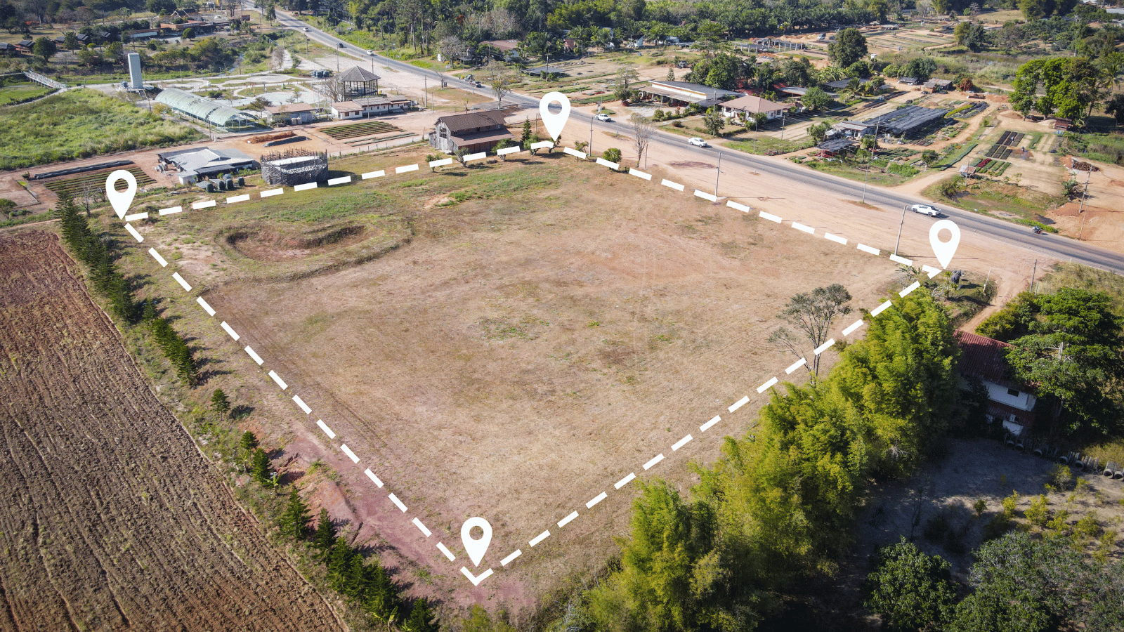
Coordinate Reference Systems (CRS) and Geodetic Datums: What’s the difference?

Coordinate Reference Systems (CRS) and Geodetic Datums: What’s the difference?

Coordinate Reference Systems (CRS) and geodetic datums are both used to represent the Earth’s surface, but they are different concepts, and importantly, serve different purposes. We provide definitions, highlight their differences and considerations for practical applications.

Coordinate Reference System (CRS)

A CRS is a coordinate-based system that provides a standardised framework for describing and locating points on the Earth’s surface. CRS is primarily used to represent specific locations on the Earth’s surface with precision and consistency.

A CRS can also be referred to as a spatial reference system (SRS) in many cases.

It defines a set of coordinates that can be used to represent the location of a point on the Earth’s surface.

A CRS typically includes a reference point (an origin), a set of axes (coordinate axes), and a unit of measurement (such as metres).

Geodetic Datum

A geodetic datum, on the other hand, is a mathematical model that defines the shape and size of the Earth’s surface, as well as the location of a reference point (the geodetic origin) and the orientation of the axes.

A geodetic datum provides the framework for measuring and comparing positions on the Earth’s surface.

It includes parameters describing the Earth’s ellipsoidal shape (semi-major and semi-minor axes), the flattening of the Earth, and the position of the datum origin.

Geodetic datums are essential for achieving high accuracy in geospatial measurements, especially over large areas.

What’s the difference?

While a CRS and a geodetic datum both provide frameworks for representing the Earth’s surface, they are different in their scope and purpose.

They serve distinct purposes in spatial representation and measurement.

The main differences between Coordinate Reference Systems and Geodetic Datums

Coordinate Reference Systems (CRS)Geodetic Datums
USESA CRS is used to represent the location of a point on the Earth's surfaceA geodetic datum is used to define the shape and size of the Earth's surface and the reference point used to measure positions
PRIMARY FOCUSA CRS deals primarily with coordinate systemA geodetic datum deals with the underlying shape and size of the Earth's reference ellipsoid
DEFINITIONSCRS definitions typically remain consistentGeodetic datums may evolve over time due to improvements in measurement techniques and advancements in geodesy
OPTIONSMultiple CRS are availableMultiple geodetic datums are available

It’s important to note that in many cases, CRSs are defined based on specific geodetic datums, ensuring compatibility and accuracy in spatial representations.

For example, the UTM system uses the WGS84 geodetic datum.

The decision between which CRS or geodetic datum to use

There are multiple choices of both CRS and geodetic datums available for users to select from.

The choice of CRS and geodetic datum depends on various factors such as the geographic region, application, and desired level of accuracy.

Geographic Region

Geographic Region

Different regions of the world may use specific CRS and geodetic datum combinations that are optimised for that region’s geographical characteristics.

Learn about the geodetic datums we use and reference in Australia.

Applications

Application

The type of application you’re working on can influence your choice of CRS and geodetic datum.

For example, surveying and mapping applications often require high accuracy, so a CRS and geodetic datum that offer precision are chosen. On the other hand, less accurate CRS and datum choices may be suitable for applications like general-purpose Geographic Information Systems or web mapping.

Accuracy

Desired Level of Accuracy

The level of precision required for a particular project or task is a crucial deciding factor. Some CRS and geodetic datum combinations are designed to provide centimetre-level accuracy, while others may provide accuracy at the metre or even decimetre level. So the choice really depends on the project’s specific accuracy requirements.

In practice, these above factors need to be carefully considered to ensure users choose the CRS and geodetic datum that is appropriate and aligns to their needs.

Considerations include whether it accurately represents geospatial data, can be integrated seamlessly with other data sources or used in specific analysis or modeling purposes. This will help avoid errors and inconsistencies in geospatial data handling and analysis.

Practical uses for CRS and geodetic datums

In practical terms, when working with geospatial data and mapping, you often need to specify both the CRS and the geodetic datum to ensure accurate and consistent spatial referencing and calculations. Keep in mind different geographic regions and applications may use specific datums and CRS to meet their needs, so understanding the distinction between them is essential for accurate geospatial referencing and analysis.

How to set these in Snowflake

If using a Geography data type the CRS used is WGS 84 and cannot be changed.

If using the Geometry data type, the CRS (or SRS) can be set with the ST_SETSRID function. To change the CRS of a geometry, use the ST_TRANSFORM function.

SELECT
ST_TRANSFORM(
ST_GEOMFROMWKT('POINT(389866.35 5819003.03)', 32633),
3857
) AS transformed_geom;

Read more blogs from The Proptech Cloud

Crafting a Storm Surge and Hurricane Risk Rating for Coastal Properties

A high-level approach to developing a storm surge and hurricane risk rating system to guide stakeholders with a vested interest in coastal properties.

How Proptech Is Revolutionising Real Estate

Proptech is the dynamic intersection of property and technology, and it’s reshaping real estate. And there’s still a huge potential for growth.

What is the Australian Statistical Geography Standard (ASGS)?

The ASGS is used to better understand where people live and how communities are formed.

How to Incorporate Mesh Blocks into Datasets

Mesh blocks can enhance the precision and relevance of geospatial and proptech analyses. Here are some tips and steps to incorporate mesh blocks into datasets.

Australia’s Migration Trends: Where Are People Moving To?

This detailed visual analysis for Australia’s major capital cities breaks down how net migration trends are evolving across different regions.

What is a Geodetic Datum?

What is a Geodetic Datum?

A geodetic datum can be described as a reference point or starting line that helps us measure and describe locations on the Earth’s surface.

Let’s use a sporting example to explain the concept.

Say you’re playing baseball, and have a home base where you start your game. This home base is like a geodetic datum. It’s a fixed point on the field that everyone agrees on as the reference point for scoring runs.

In baseball, all the distances are measured from home base. For example, how far you hit the ball or how far you run around the bases is based on your relationship to that central point. Without a fixed home base, it would be challenging to keep track of scores and positions accurately.

In the world of geography and mapping, Earth’s surface is vast and not perfectly flat, so we need a similar reference point. And a geodetic datum does just this, serving as a foundation for mapping and navigation.

What is a geodetic datum?

A geodetic datum is a model that defines the shape and size of the Earth’s surface, as well as the location of a reference point (the origin) and the orientation of the axes.

A geodetic datum provides the framework for measuring and comparing positions on the Earth’s surface.

Components

A geodetic datum consists of several key components:

  • Reference Ellipsoid: Describes the shape of the Earth (e.g., WGS 84).
  • Geodetic Center: Specifies the Earth’s centre point.
  • Prime Meridian: Defines the longitudinal reference line (e.g., Greenwich Meridian).

What purposes does a geodetic datum serve?

Geodetic datums serve as a reference framework for defining the shape of the Earth and its orientation. They provide a consistent basis for measuring latitude, longitude, elevations and are essential in geospatial analysis.

Geodetic datums help us create accurate maps, GPS navigation and positioning, and other location-based systems by giving us a standardised starting point to measure distances and positions from.

Different types of geodetic datums

Some geodetic datums are global, aiming to provide a worldwide reference framework, although many countries and regions around the world commonly use different geodetic datums to best fit the curvature of the Earth in their boundaries for greater accuracy. They may also vary from one region to another due to historical, technical, and practical reasons.

Examples of commonly used geodetic datums include the World Geodetic System 1984 (WGS84) and the North American Datum 1983 (NAD83).

Geodetic datum used in property and real estate

How geodetic datums are used in property and real estate

Geodetic datums are fundamental to property and real estate by providing a standard referencing system for defining property boundaries, mapping, location-based services, and decision-making processes related to land use and property transactions.

  • Property Surveys:
    When a property is surveyed, geodetic datums provide a reference framework for precisely locating property boundaries and corners. Surveyors use coordinates based on the datum to define the property’s position on the Earth’s surface accurately. This is critical for property boundaries, ensuring that the land’s legal description is accurate.
  • Land Records and Title Deeds:
    Property records and title deeds often include coordinate information based on a specific geodetic datum. This information ensures the accuracy and consistency of land ownership records.
  • Geographic Information Systems (GIS) Mapping: GIS used in the real estate industry rely on geodetic datums to create digital maps. These maps help real estate professionals and government agencies manage property information, zoning, and land use more effectively.
  • Location-Based Services:
    Real estate agents and online platforms use mapping applications that rely on geodetic datums to display property locations accurately. This helps potential buyers or renters understand the property’s precise location and nearby amenities.
  • Property Valuation:
    Geodetic datums can be used in property valuation models to consider factors like the property’s location, proximity to schools, transportation, and other geographic features. These factors can affect a property’s value.
  • Land Use Planning:
    Urban and regional planners use geodetic datums to assess the suitability of land for different purposes, such as residential, commercial, or industrial development. They consider geographic factors and zoning regulations.
  • Environmental Impact Assessment:
    When evaluating the environmental impact of a real estate development, geodetic datums help assess factors like proximity to water bodies, floodplains, and protected areas.
  • Infrastructure Development:
    Geodetic datums are essential for planning and constructing infrastructure, such as roads, utilities, and public transportation systems. Accurate location information ensures that developments are built correctly.
  • Property Insurance:
    Insurers may use geodetic datums to assess the risk associated with a property’s location, particularly regarding natural disasters like floods or earthquakes.

Geodetic datums are used widely by proptechs and serve a number of purposes in real estate and property management. 

Read our blog to learn about the geodetic datums we use and reference in Australia.

Read more blogs from The Proptech Cloud

Crafting a Storm Surge and Hurricane Risk Rating for Coastal Properties

A high-level approach to developing a storm surge and hurricane risk rating system to guide stakeholders with a vested interest in coastal properties.

How Proptech Is Revolutionising Real Estate

Proptech is the dynamic intersection of property and technology, and it’s reshaping real estate. And there’s still a huge potential for growth.

What is the Australian Statistical Geography Standard (ASGS)?

The ASGS is used to better understand where people live and how communities are formed.

How to Incorporate Mesh Blocks into Datasets

Mesh blocks can enhance the precision and relevance of geospatial and proptech analyses. Here are some tips and steps to incorporate mesh blocks into datasets.

Australia’s Migration Trends: Where Are People Moving To?

This detailed visual analysis for Australia’s major capital cities breaks down how net migration trends are evolving across different regions.

What’s the Difference Between GDA94 and GDA2020?

What’s the Difference Between GDA94 and GDA2020?

Geodetic datums, or geodetic systems, are often used by proptechs. Here is a rundown of everything you need to know about the different geodetic datums we use and reference in Australia.

What is a geodetic datum?

A geodetic datum is a set of reference points and parameters used to define the shape and orientation of the Earth’s surface for mapping and surveying purposes. It provides a coordinate system that allows locations on the Earth’s surface to be accurately described and located. In Australia, we use Geodetic Datum of Australia 1994(DA94) and Geodetic Datum of Australia 2020 (GDA2020).

History of Australia’s geodetic datums

Prior to GDA94, Australian surveyors primarily used the Australian Geodetic Datum 1966 (AGD66), which was based on a network of ground-based survey points and astronomical observations.

AGD66 was the standard datum used for mapping and surveying in Australia for several decades until it was superseded by GDA94 in the 1990s.

The decision to switch to GDA94 was driven by the need for a more accurate and up-to-date geodetic datum that could take advantage of advances in geospatial technology such as GPS. AGD66 was also affected by tectonic movements and other changes in the Earth’s surface, which made it increasingly difficult to use for accurate positioning and navigation.

GDA94 (Geocentric Datum of Australia 1994) was the geodetic datum used in Australia from 1994. Based on a mathematical model of the Earth’s surface defined using measurements from a network of ground-based survey points, and used as the standard datum for mapping and surveying in Australia.

Now, GDA2020 (Geocentric Datum of Australia 2020) is the current geodetic datum used in Australia. It was introduced in 2017 to replace GDA94 and is based on more recent measurements of the Earth’s surface using advanced satellite and ground-based technology.

GDA2020 provides a more accurate representation of the Earth’s surface than GDA94, and is designed to be compatible with global positioning systems (GPS) and other modern geospatial technologies.

Even though AGD66, and to some extent GDA94, are no longer the primary datums used in Australia, it’s still important to maintain historical data that was referenced to this datum. It is possible to transform data from AGD66 to GDA94 or GDA2020 using appropriate transformation parameters to ensure compatibility and accuracy when comparing or integrating data from different sources.

Conversions between geodetic datums

Conversions between AGD66 and GDA94 are not 100% accurate, because the two datums are based on different mathematical models of the Earth’s surface with different reference points and parameters.

To convert data from AGD66 to GDA94 (or vice versa), a mathematical transformation must be applied that takes the differences between the two datums into account. This transformation involves adjusting the latitude, longitude, and height values of the data to align with the new datum.

However, there are many factors that can affect the accuracy of this transformation, such as:

  1. The quality and accuracy of the original data: If the original data was collected using imprecise or inaccurate methods, the transformation may introduce additional errors or inaccuracies.
  2. The complexity of the transformation: Some transformations may require more complex mathematical models or additional parameters to be specified, which can increase the likelihood of errors.
  3. The location and terrain of the data: The accuracy of the transformation can vary depending on the location and terrain of the data. Some areas may be more affected by tectonic movements or other changes in the Earth’s surface, which can make the transformation more challenging.
  4. The type of data being transformed: Different types of data (e.g. points, lines, polygons) may require different transformation methods or parameters, which can affect the accuracy of the transformation.

While conversions between AGD66 and GDA94 can be relatively precise, they’re not 100% accurate. This is due to the inherent differences between the two datums, and the potential for errors or inaccuracies in the transformation process. It’s important to use appropriate transformation methods and understand the limitations and potential sources of error when converting data between different geodetic datums.

The difference between GDA94 and GDA2020

The key differences

The main difference between GDA94 and GDA2020 is their accuracy and the methods used to define them. GDA2020 is a more accurate and up-to-date datum, with improvements in the modeling of the Earth’s surface that take into account changes in its shape over time. This means that positions and distances measured using GDA2020 are more accurate than those measured using GDA94. Additionally, GDA2020 is designed to be compatible with modern geospatial technologies and is expected to be used for many years to come.

It’s worth noting that the difference between GDA94 and GDA2020 may not be significant for many applications, particularly those that don’t require high levels of accuracy. However, for applications that require precise positioning or measurement, such as surveying or mapping, using the correct geodetic datum is imperative to ensure accurate results.

Differences in distance and direction

The average distance and direction difference between GDA94 and GDA2020 depends on the location on the Earth’s surface. In general, the differences between the two datums are greatest in areas with high tectonic activity or areas where the Earth’s surface is undergoing significant changes, such as due to land subsidence or sea level rise.

According to Geoscience Australia, the organisation responsible for geodetic information and services in Australia, the average difference between GDA94 and GDA2020 in Australia is around 1.5 meters. However, this value can vary significantly depending on the location, with some areas showing differences of several meters or more.

The direction of the difference between the two datums also varies depending on the location, as it is related to the direction and magnitude of any tectonic movements or changes in the Earth’s surface. In general, the direction of the difference is determined by the vector between the two datums at a given location.

It’s important to note that the difference between GDA94 and GDA2020 is not constant over time and may continue to change in the future. This is because the Earth’s surface is constantly changing due to tectonic activity, sea level rise, and other factors. As such, it’s important to regularly update geodetic data and use the most up-to-date geodetic datum for accurate positioning and navigation.

Migrating from GDA94 to GDA2020

The differences between the two means that migrating from GDA94 to GDA2020 can present several challenges and issues, particularly for organisations or projects that rely heavily on geospatial data.

Some of the key issues with migrating to GDA2020 include: 

  1. Data compatibility: Data that was created using GDA94 may not be compatible with GDA2020. This can cause issues when trying to integrate or compare datasets that use different datums.
  2. Application compatibility: Applications that were designed to work with GDA94 may not be compatible with GDA2020. This can require updates or modifications to existing software or the adoption of new tools.
  3. Training and expertise: Staff who work with geospatial data may need to be trained on the new GDA2020 datum and its associated tools and workflows. This can take time and resources.
  4. Time and cost: Migrating to GDA2020 can be a complex and time-consuming process, particularly for large organisations or projects. There may be costs associated with updating software, purchasing new equipment, or retraining staff.
  5. Accuracy: While GDA2020 is a more accurate datum than GDA94, some existing data may still be more accurate when referenced to GDA94. This can make it difficult to compare or integrate data from different sources.
  6. Data transformation: In some cases, it may be necessary to transform data from GDA94 to GDA2020, which can introduce errors or inaccuracies. The accuracy of the transformation depends on the quality of the original data and the transformation method used.

Migrating from GDA94 to GDA2020 requires careful planning and consideration of the potential issues and challenges. It’s crucial to work closely with geospatial experts and stakeholders to ensure a smooth and successful transition.

What is WGS84 and why is it used by software?

WGS84 (World Geodetic System 1984) is a geodetic datum used for positioning and navigation purposes. It defines a reference system for the Earth’s surface that allows locations to be specified in latitude and longitude coordinates.

The WGS84 datum was developed by the United States Department of Defense for use by the military and intelligence agencies, but it has since become the standard geodetic datum used by many organisations and applications around the world, including GPS (Global Positioning System) devices and mapping software.

The WGS84 datum is based on a mathematical model of the Earth’s surface that takes into account its shape, size, and rotation. It defines a set of reference points and parameters that allow positions on the Earth’s surface to be accurately calculated and communicated.

The WGS84 datum is widely used because it is compatible with GPS and other global navigation systems, allowing precise positioning and navigation in real-time. However, while there may be regional differences in the Earth’s surface that are not fully captured by the WGS84 model, that other geodetic datums may be more appropriate for certain applications or regions.

How to convert between GDA2020 and WGS84

To convert between GDA2020 (Geocentric Datum of Australia 2020) and WGS84 (World Geodetic System 1984), you can use coordinate transformation parameters provided by geodetic authorities. The transformation process involves converting coordinates from one datum to another using a mathematical model.

In the case of GDA2020 and WGS84, the transformation parameters provided by the Intergovernmental Committee on Surveying and Mapping (ICSM) in Australia are known as the National Transformation Version 2 (NTv2) grid files. These grid files contain the necessary information for accurate transformations.

The accuracy of the transformation depends on the specific region and the quality of the NTv2 grid files used. Always use the most up-to-date and accurate transformation parameters available from reputable sources.

To convert coordinates between the GDA2020 (Geocentric Datum of Australia 2020) and WGS84 (World Geodetic System 1984) datums using Python, you can utilise the pyproj library. pyproj provides a convenient interface to the PROJ library, which is a widely used cartographic projection and coordinate transformation library.

Usage in Australia

In Australia, a lot of data providers are providing data sets in both GDA94 and GDA2020 geodetic datums because the uptake of GDA2020 is not universal. Most data providers of spatial data sets will reference the geodetic datum used to build the data set.

When combining geospatial data sets, ensure you are using a consistent geodetic datum to prevent incorrectly linking two or more shapes.

Read more blogs from The Proptech Cloud

Crafting a Storm Surge and Hurricane Risk Rating for Coastal Properties

A high-level approach to developing a storm surge and hurricane risk rating system to guide stakeholders with a vested interest in coastal properties.

How Proptech Is Revolutionising Real Estate

Proptech is the dynamic intersection of property and technology, and it’s reshaping real estate. And there’s still a huge potential for growth.

What is the Australian Statistical Geography Standard (ASGS)?

The ASGS is used to better understand where people live and how communities are formed.

How to Incorporate Mesh Blocks into Datasets

Mesh blocks can enhance the precision and relevance of geospatial and proptech analyses. Here are some tips and steps to incorporate mesh blocks into datasets.

Australia’s Migration Trends: Where Are People Moving To?

This detailed visual analysis for Australia’s major capital cities breaks down how net migration trends are evolving across different regions.