Geohashes are an incredibly useful tool when it comes to spatial analysis. They serve as an encoding system that translates geographic coordinates into a short string of letters and digits, which simplifies and optimises geospatial operations.
One area where geohashes shine is in making geospatial joins more efficient. In this blog, we’ll dive into what geohashes are, and how you can leverage Snowflake’s ST_GEOHASH function to improve your geospatial joins in Snowflake.
What is a geohash?
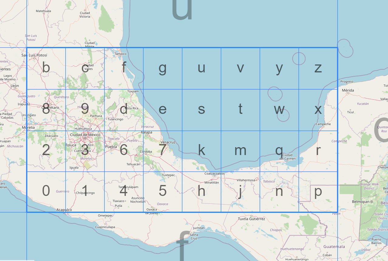
A geohash is a hierarchical spatial data structure that subdivides space into a grid of cells, each cell having a unique string identifier. Geohashes convert a two-dimensional geographic coordinate (latitude and longitude) into this alphanumeric string. The length of the string determines the precision of the geohash; a longer string means a more precise location.
Read our blog on What is a Geohash for a detailed overview.
Source: Geohash Explorer
How geohashes make geospatial joins more efficient
Geospatial joins can be computationally expensive because they often require pairing each record in one dataset with every record in another to calculate distances or find overlaps. This can lead to a computational complexity of O(N*M), which is not ideal for large datasets.
Geohashes simplify this problem by converting the geospatial coordinates into strings. When you want to join based on geographic proximity, you can simply perform a string comparison, which is far less computationally expensive than a full spatial join.
Snowflake and ST_GEOHASH
Snowflake offers native support for geospatial functions, including ST_GEOHASH. Below is a simple example of how you can use this function to create a geohash in Snowflake:
-- Create a geohash for a specific latitude and longitude
SELECT ST_GEOHASH(37.7749, -122.4194, 12) AS geohash;37.7749 is the latitude, -122.4194 is the longitude, and 12 is the precision of the geohash.To perform a geospatial join using geohashes, you can do the following:
-- Create two tables with geospatial data
CREATE TABLE locations1 (id INT, latitude FLOAT, longitude FLOAT);
CREATE TABLE locations2 (id INT, latitude FLOAT, longitude FLOAT);

-- Populate tables (this is just a representation)
-- ...

-- Add a geohash column to both tables
ALTER TABLE locations1 ADD COLUMN geohash STRING;
ALTER TABLE locations2 ADD COLUMN geohash STRING;

-- Update the geohash columns using ST_GEOHASH
UPDATE locations1 SET geohash = ST_GEOHASH(latitude, longitude, 12);
UPDATE locations2 SET geohash = ST_GEOHASH(latitude, longitude, 12);

-- Perform the join using the geohash
SELECT a.*, b.*
FROM locations1 a, locations2 b
WHERE a.geohash = b.geohash;
Geohash – Streamlining geospatial joins
Geohashes offer a streamlined way to perform geospatial joins, drastically reducing the computational resources required. With native functions like ST_GEOHASH in Snowflake, it’s easier than ever to incorporate geohashes into your geospatial workflows. By leveraging the power of geohashes, you can perform complex geospatial analyses more efficiently, saving both time and money.


